
Ragiv:Drachten 6.09614E 53.11089N.jpg

Size of this preview: 800 × 599 pixels. Other resolutions: 320 × 240 pixels • 640 × 479 pixels • 1,024 × 766 pixels • 1,280 × 958 pixels.
Ragiv rigik (1,280 × 958 pixel, ragivagret: 159 KB, pated MIME: image/jpeg)
Plän brefik
| Bepenam |
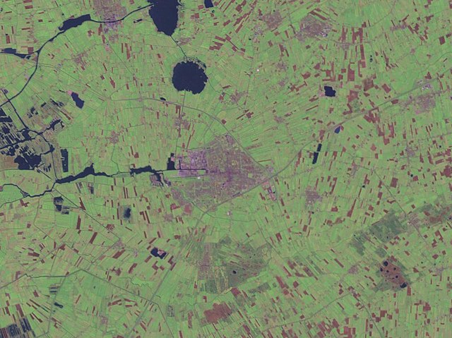
English: Drachten, Netherlands. Satellite view. |
| Dät | 15 mayul 2005 (upload date) |
| Fon | Satellite imagery taken from NASA World Wind software (by screenshot) |
| Lautan | NASA |
| Object location | | View this and other nearby images on: OpenStreetMap |
|---|
Dälastad
| This image is in the public domain because it is a screenshot from NASA’s globe software World Wind using a public domain layer, such as Blue Marble, MODIS, Landsat, SRTM, USGS or GLOBE.
|
 |
Jenotem ragiva
Välolös däti/timi ad logön ragivi soäsä äbinon ün tim at.
| Dät/Tim | Magodil | Mafots | Geban | Küpet | |
|---|---|---|---|---|---|
| anuik | 14:02, 2005 mayul 15id | | 1,280 × 958 (159 KB) | Rex | NASA World Wind screenshot. {{PD-USGov-NASA}} Category:Maps of The Netherlands |
Yüms
Pads sököl payümons ko pad at:
Ragivigeb Valöpik
The following other wikis use this file:
- Geb su fy.wikipedia.org
- Geb su nds-nl.wikipedia.org
- Geb su zea.wikipedia.org