
Ragiv:Map of Illinois highlighting DuPage County.svg

Size of this PNG preview of this SVG file: 336 × 599 pixels. Other resolutions: 134 × 240 pixels • 269 × 480 pixels • 430 × 768 pixels • 574 × 1,024 pixels • 1,148 × 2,048 pixels • 3,453 × 6,157 pixels.
Ragiv rigik (ragiv in fomät: SVG, magodaziöbs 3,453 × 6,157, gretot: 85 KB)
Plän brefik
| Bepenam |
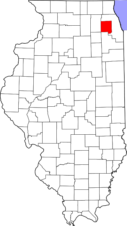
English: This is a locator map showing DuPage County in Illinois. For more information, see Commons:United States county locator maps. |
| Dät | |
| Fon |
Vobot okik: English: The maps use data from nationalatlas.gov, specifically countyp020.tar.gz on the Raw Data Download page. The maps also use state outline data from statesp020.tar.gz. The Florida maps use hydrogm020.tar.gz to display Lake Okeechobee. |
| Lautan | David Benbennick |
Dälastad
| I, the copyright holder of this work, release this work into the public domain. This applies worldwide. In some countries this may not be legally possible; if so: I grant anyone the right to use this work for any purpose, without any conditions, unless such conditions are required by law. |
Jenotem ragiva
Välolös däti/timi ad logön ragivi soäsä äbinon ün tim at.
| Dät/Tim | Magodil | Mafots | Geban | Küpet | |
|---|---|---|---|---|---|
| anuik | 11:33, 2006 febul 12id | | 3,453 × 6,157 (85 KB) | David Benbennick | {{subst:User:Dbenbenn/clm|county=DuPage County|state=Illinois}} |
| 11:09, 2006 febul 12id |  | 3,453 × 6,157 (85 KB) | David Benbennick | {{subst:User:Dbenbenn/clm|county=DuPage County|state=Illinois}} |
Yüms
Pads nonik peyümons ad ragiv at.
Ragivigeb Valöpik
The following other wikis use this file:
- Geb su ar.wikipedia.org
- شيكاغو
- مقاطعة دوبيج (إلينوي)
- أورورا (إلينوي)
- باتافيا (إلينوي)
- دارين (إلينوي)
- شامبورغ (إلينوي)
- دانرز غروف (إلينوي)
- إديسون (إلينوي)
- لومبارد (إلينوي)
- بوليغ بروك (إلينوي)
- كارول ستريم (إلينوي)
- قرية إلك غروف (إلينوي)
- هينديل (إلينوي)
- أوك بروك (إلينوي)
- بارتليت (إلينوي)
- غلن إلين (إلينوي)
- هانوور بارك (إلينوي)
- ليسل (إلينوي)
- وودبريدج (إلينوي)
- ايتاسكا (إلينوي)
- ليمونت (إلينوي)
- فيلا بارك (إلينوي)
- وست مونت (إلينوي)
- ويلوو سبرينغز (إلينوي)
- وينفيلد (إلينوي)
- بنسنفيل (إلينوي)
- بلومينغديل (إلينوي)
- بور ريدج (إلينوي)
- غلنديل هايتس (إلينوي)
- روسلي (إلينوي)
- واين (إلينوي)
- كلارندون هيلز (إلينوي)
- إلمهورست
- ويتون (إلينوي)
- أوكبروك تراس
- سانت تشارلز (إلينوي)
- ويست شيكاغو
- وود دايل
- وستون (إلينوي)
- ويلوبروك (إلينوي)
- نابرفيل (إلينوي)
- وارينفيل (إلينوي)
- قالب:مقاطعة دوبيج (إلينوي)
- Geb su azb.wikipedia.org
- Geb su bg.wikipedia.org
- Geb su bpy.wikipedia.org
- Geb su ca.wikipedia.org
View more global usage of this file.