
Ragiv:Map of Maine highlighting Penobscot County.svg

Size of this PNG preview of this SVG file: 400 × 600 pixels. Other resolutions: 160 × 240 pixels • 320 × 480 pixels • 512 × 768 pixels • 683 × 1,024 pixels • 1,366 × 2,048 pixels • 3,252 × 4,876 pixels.
Ragiv rigik (ragiv in fomät: SVG, magodaziöbs 3,252 × 4,876, gretot: 131 KB)
Plän brefik
| Bepenam |
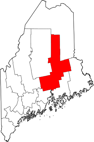
English: Locator map showing Penobscot County — in Maine.
|
| Dät | |
| Fon |
Vobot okik: English: The maps use data from nationalatlas.gov, specifically countyp020.tar.gz on the Raw Data Download page. The maps also use state outline data from statesp020.tar.gz. The Florida maps use hydrogm020.tar.gz to display Lake Okeechobee. |
| Lautan | David Benbennick |
Dälastad
| I, the copyright holder of this work, release this work into the public domain. This applies worldwide. In some countries this may not be legally possible; if so: I grant anyone the right to use this work for any purpose, without any conditions, unless such conditions are required by law. |
Jenotem ragiva
Välolös däti/timi ad logön ragivi soäsä äbinon ün tim at.
| Dät/Tim | Magodil | Mafots | Geban | Küpet | |
|---|---|---|---|---|---|
| anuik | 12:47, 2006 febul 12id | | 3,252 × 4,876 (131 KB) | David Benbennick | {{subst:User:Dbenbenn/clm|county=Penobscot County|state=Maine|type=county}} |
Yüms
Pads nonik peyümons ad ragiv at.
Ragivigeb Valöpik
The following other wikis use this file:
- Geb su ar.wikipedia.org
- مقاطعة بينوبسكوت (مين)
- بانجور (مين)
- أولد تاون
- بريور
- بورلينغتون (مين)
- كارمل (مين)
- تشارلستون (مين)
- تشيستر (مين)
- كليفتون (مين)
- كورينا (مين)
- كورينث (مين)
- ديكستر (مين)
- ديكسمونت (مين)
- إيست ميلينكوت (مين)
- إدينغتون (مين)
- إدينبورغ (مين)
- إينفيلد (مين)
- إتنا (مين)
- إيكستر (مين)
- غارلاند (مين)
- غرينبوش (مين)
- هامبدين (مين)
- هيرمون (مين)
- هولدين (مين)
- هاولاند (مين)
- هودسون (مين)
- كيندوسكيغ (مين)
- لاغرانغ (مين)
- ليكفيل (مين)
- لي (مين)
- ليفانت (مين)
- لينكولن (مين)
- لوويل (مين)
- ماتاوامكيغ (مين)
- ماكسفيلد (مين)
- ميلفورد (مين)
- ميلينكوت (مين)
- مونت تشاس (مين)
- نيوبورغ (مين)
- أورونو (مين)
- أورينغتون (مين)
- باسادومكيغ (مين)
- باتين (مين)
- قائمة مقاطعات مين
- نيوبورت (مين)
- قالب:مقاطعة بينوبسكوت (مين)
- Geb su be.wikipedia.org
- Geb su bg.wikipedia.org
- Geb su bpy.wikipedia.org
View more global usage of this file.