
Ragiv:LocationAU.png
Gretot gudikum no pagebidon.
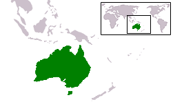
LocationAU.png (251 × 161 pixel, ragivagret: 6 KB, pated MIME: image/png)
Plän brefik
Country locator map for Australia
Uploaded by en:User:E Pluribus Anthony; originally created for the English Wikipedia by en:User:Vardion

|
File:LocationAU.svg is a vector version of this file. It should be used in place of this PNG file when not inferior.
File:LocationAU.png → File:LocationAU.svg
For more information, see Help:SVG. |
 |
Dälastad
| I, the copyright holder of this work, release this work into the public domain. This applies worldwide. In some countries this may not be legally possible; if so: I grant anyone the right to use this work for any purpose, without any conditions, unless such conditions are required by law. |
Jenotem ragiva
Välolös däti/timi ad logön ragivi soäsä äbinon ün tim at.
| Dät/Tim | Magodil | Mafots | Geban | Küpet | |
|---|---|---|---|---|---|
| anuik | 19:37, 2013 novul 12id | | 251 × 161 (6 KB) | Ischa1 | Deze afbeelding wordt gebruikt voor pagina's over het LAND Australië, de andere afbeelding geeft Australië echter als continent weer. Daarom aangepast. |
| 16:22, 2006 tobul 5id |  | 2,759 × 1,404 (50 KB) | Urhixidur | Higher resolution version, including territories (Ashmore and Cartier, Christmas, Cocos (Keeling), Heard and MacDonald islands) | |
| 15:08, 2006 mäzul 1id |  | 250 × 115 (10 KB) | Drat | Optimised with OptiPNG. | |
| 08:41, 2006 yanul 29id |  | 250 × 115 (13 KB) | E Pluribus Anthony~commonswiki | Country locator map for Australia |
Yüms
Pads sököl payümons ko pad at:
Ragivigeb Valöpik
The following other wikis use this file:
- Geb su ba.wikipedia.org
- Geb su bg.wikipedia.org
- Geb su cs.wikipedia.org
- Geb su cv.wikipedia.org
- Geb su de.wikinews.org
- Geb su el.wiktionary.org
- Geb su en.wikipedia.org
- Geb su es.wikipedia.org
- Categoría:Fauna de Australia
- Categoría:Mamíferos de Australia
- Categoría:Aves de Australia
- Categoría:Reptiles de Australia
- Categoría:Naturaleza de Australia
- Portal:Australia
- Categoría:Insectos de Australia
- Categoría:Anfibios de Australia
- Categoría:Peces de Australia
- Categoría:Arácnidos de Australia
- Categoría:Moluscos de Australia
- Pseudechis porphyriacus
- Geb su fr.wikipedia.org
- Geb su fur.wikipedia.org
- Geb su hif.wikipedia.org
- Geb su hr.wikipedia.org
- Geb su hu.wikipedia.org
- Geb su id.wikipedia.org
- Geb su it.wikipedia.org
- Geb su ja.wikipedia.org
- Geb su ka.wikipedia.org
- Geb su ku.wiktionary.org
- Geb su kv.wikipedia.org
- Geb su ms.wikipedia.org
- Geb su nds.wikipedia.org
- Geb su nl.wikipedia.org
- Geb su nl.wikivoyage.org
- Geb su nn.wikipedia.org
- Geb su no.wikipedia.org
- Geb su nrm.wikipedia.org
- Geb su pl.wikipedia.org
- Geb su pl.wikinews.org
- Geb su pl.wikiquote.org
View more global usage of this file.