
Ragiv:All Saints Parish Church, Broseley - geograph.org.uk - 1030739.jpg
Gretot gudikum no pagebidon.
All_Saints_Parish_Church,_Broseley_-_geograph.org.uk_-_1030739.jpg (640 × 480 pixel, ragivagret: 55 KB, pated MIME: image/jpeg)
This is a photo of listed building number 1053895. |
Plän brefik
| Bepenam |
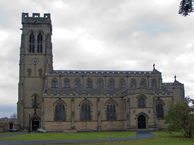
English: All Saints' parish church, Broseley, Shropshire, seen from south-southeast |
| Dät | |
| Fon | From geograph.org.uk |
| Lautan | Mike White |
| Attribution (required by the license) | Mike White / All Saints Parish Church, Broseley / |
| Camera location | | View this and other nearby images on: OpenStreetMap |
|---|
_heading:292.00&language=vo)
| Object location | | View this and other nearby images on: OpenStreetMap |
|---|
_heading:292.00&language=vo)
Dälastad

|
This image was taken from the Geograph project collection. See this photograph's page on the Geograph website for the photographer's contact details. The copyright on this image is owned by Mike White and is licensed for reuse under the Creative Commons Attribution-ShareAlike 2.0 license.
|
This file is licensed under the Creative Commons Attribution-Share Alike 2.0 Generic license.
Attribution: Mike White
- Binol libik:
- to share – to copy, distribute and transmit the work
- to remix – to adapt the work
- Under the following conditions:
- attribution – You must give appropriate credit, provide a link to the license, and indicate if changes were made. You may do so in any reasonable manner, but not in any way that suggests the licensor endorses you or your use.
- share alike – If you remix, transform, or build upon the material, you must distribute your contributions under the same or compatible license as the original.
Jenotem ragiva
Välolös däti/timi ad logön ragivi soäsä äbinon ün tim at.
| Dät/Tim | Magodil | Mafots | Geban | Küpet | |
|---|---|---|---|---|---|
| anuik | 17:05, 2011 febul 23id | | 640 × 480 (55 KB) | GeographBot | == {{int:filedesc}} == {{Information |description={{en|1=All Saints Parish Church, Broseley This church has gargoyles which project far from the tower, and some unusual cast-iron gravestones.}} |date=2008-11-02 |source=From [http://www.geograph.org.uk/pho |
Yüms
Pads sököl payümons ko pad at:
Ragivigeb Valöpik
The following other wikis use this file:
- Geb su ar.wikipedia.org
- Geb su arz.wikipedia.org
- Geb su azb.wikipedia.org
- Geb su ceb.wikipedia.org
- Geb su cy.wikipedia.org
- Geb su dag.wikipedia.org
- Geb su en.wikipedia.org
- Geb su es.wikipedia.org
- Geb su fa.wikipedia.org
- Geb su fr.wikipedia.org
- Geb su ga.wikipedia.org
- Geb su he.wikipedia.org
- Geb su it.wikipedia.org
- Geb su lld.wikipedia.org
- Geb su pl.wikipedia.org
- Geb su sv.wikipedia.org
- Geb su www.wikidata.org
- Geb su zh-min-nan.wikipedia.org
- Geb su zh.wikipedia.org