
Ragiv:Camposanto e il fiume Panaro.jpg

Size of this preview: 800 × 600 pixels. Other resolutions: 320 × 240 pixels • 640 × 480 pixels • 1,024 × 768 pixels • 1,280 × 960 pixels • 2,560 × 1,920 pixels • 3,072 × 2,304 pixels.
Ragiv rigik (3,072 × 2,304 pixel, ragivagret: 1.73 MB, pated MIME: image/jpeg)
Plän brefik
| Bepenam |
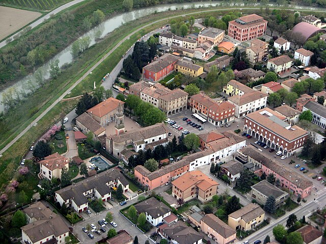
English: Photo of the centre taken from an airplane.
Italiano: Foto del centro scattata da un velivolo. |
| Dät | |
| Fon | https://www.panoramio.com/photo/1832583 |
| Lautan | Claudio Pedrazzi https://www.panoramio.com/user/claudiopedrazzi |
| Däl (Reusing this file) |
| Camera location | | View this and other nearby images on: OpenStreetMap |
|---|
Dälastad
This file is licensed under the Creative Commons Attribution-Share Alike 3.0 Unported license.
- Binol libik:
- to share – to copy, distribute and transmit the work
- to remix – to adapt the work
- Under the following conditions:
- attribution – You must give appropriate credit, provide a link to the license, and indicate if changes were made. You may do so in any reasonable manner, but not in any way that suggests the licensor endorses you or your use.
- share alike – If you remix, transform, or build upon the material, you must distribute your contributions under the same or compatible license as the original.
Jenotem ragiva
Välolös däti/timi ad logön ragivi soäsä äbinon ün tim at.
| Dät/Tim | Magodil | Mafots | Geban | Küpet | |
|---|---|---|---|---|---|
| anuik | 14:26, 2011 mayul 9id | | 3,072 × 2,304 (1.73 MB) | Mantrace | {{Information |Description ={{en|1=Photo of the centre taken from an airplane.}} {{it|1=Foto del centro scattata da un velivolo.}} |Source =http://www.panoramio.com/photo/1832583 |Author =Claudio Pedrazzi http://www.panoramio.com/user/c |
Yüms
Pads sököl payümons ko pad at:
Ragivigeb Valöpik
The following other wikis use this file:
- Geb su ar.wikipedia.org
- Geb su azb.wikipedia.org
- Geb su bg.wikipedia.org
- Geb su br.wikipedia.org
- Geb su ceb.wikipedia.org
- Geb su ce.wikipedia.org
- Geb su de.wikipedia.org
- Geb su el.wikipedia.org
- Geb su en.wikipedia.org
- Geb su eo.wikipedia.org
- Geb su es.wikipedia.org
- Geb su eu.wikipedia.org
- Geb su fa.wikipedia.org
- Geb su fr.wikipedia.org
- Geb su hu.wikipedia.org
- Geb su hy.wikipedia.org
- Geb su ia.wikipedia.org
- Geb su it.wikipedia.org
- Geb su ja.wikipedia.org
- Geb su la.wikipedia.org
- Geb su lld.wikipedia.org
- Geb su lmo.wikipedia.org
- Geb su nl.wikipedia.org
- Geb su pl.wikipedia.org
- Geb su pms.wikipedia.org
- Geb su pt.wikipedia.org
- Geb su roa-tara.wikipedia.org
- Geb su ro.wikipedia.org
- Geb su ru.wikipedia.org
- Geb su sr.wikipedia.org
- Geb su sv.wikipedia.org
- Geb su tl.wikipedia.org
- Geb su tr.wikipedia.org
- Geb su tt.wikipedia.org
- Geb su uk.wikipedia.org
- Geb su uz.wikipedia.org
- Geb su vec.wikipedia.org
- Geb su www.wikidata.org
- Geb su zh-min-nan.wikipedia.org