
Ragiv:Friedberg (Hessen) Stadtkirche.jpg

Ragiv rigik (1,416 × 1,079 pixel, ragivagret: 91 KB, pated MIME: image/jpeg)
_Stadtkirche.jpg)
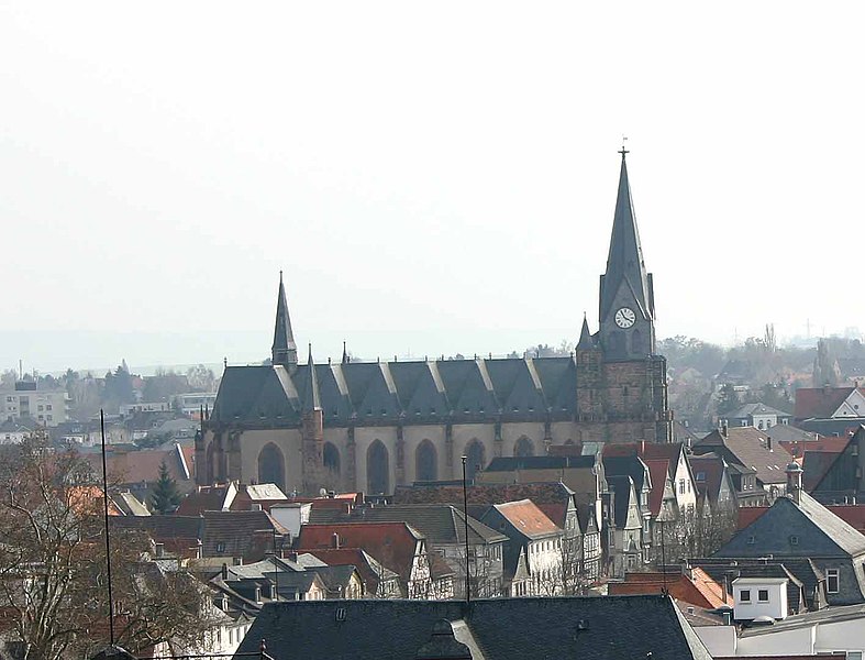
- Beschreibung: "Stadtkirche" in Friedberg
This is a picture of the Hessian Kulturdenkmal (cultural monument) with the ID 5526 (Wikidata)
|
- Quelle: selbst fotografiert am 27. März 2005
- Fotograf:
| Sven Teschke
(1964–) |
|||
|---|---|---|---|
| Description | Deutänik fotografan e lautan | ||
| Date of birth |
1964 | ||
| Location of birth | Hanau | ||
| Work period | 1985 | ||
| Work location | |||
| Authority file | |||
- Andere Versionen:
- Lizenzstatus: GNU FDL

|
Däl pagevon ad kopiedön, seagivön e/u votükön dokümi at ma Dälazöt ad Dokümam Libik: GNU, Fomam: 1.2 u nulikum fa el Free Software Foundation (Stitod: Nünömaprograms libik); nen diläds nevotükovik, nen vödems tegapada balid, e leigo nen vödems tegapada lätik. Kopied dälazöta pekeninon in diläd: Dälazöt ad Dokümam Libik: GNU panemöl. |
| This file is licensed under the Creative Commons Attribution-Share Alike 3.0 Unported license. | ||
| ||
| This licensing tag was added to this file as part of the GFDL licensing update. |
|
Das Foto habe ich als Urheber unter der „GFDL – GNU-Lizenz für freie Dokumentation“ in der Wikipedia veröffentlicht. Dies bedeutet, dass eine kostenlose, auch kommerzielle Nutzung außerhalb der Wikimedia-Projekte unter folgenden Bedingungen möglich ist:
Ich bitte um Zusendung eines Belegexemplares bzw. der URL, wo das Foto benutzt wird. Bitte schreiben Sie eine E-Mail an steschke@web.de, wenn Sie
|
|
I have published this image as author under the "GNU Free Documentation License" in Wikipedia. This means that free, commercial usage outside of Wikimedia projects under the following terms of licence is possible:
Please send me a specimen copy or the URL of the website where the image is used. Please write an email to steschke@web.de, if you
|
| Object location | | View this and other nearby images on: OpenStreetMap |
|---|
_Stadtkirche.jpg¶ms=050.336778_N_0008.755222_E_globe:Earth_class:object_type:object__&language=vo)
| Camera location | | View this and other nearby images on: OpenStreetMap |
|---|
_Stadtkirche.jpg¶ms=050.342722_N_0008.752889_E_globe:Earth_type:camera__&language=vo)
Jenotem ragiva
Välolös däti/timi ad logön ragivi soäsä äbinon ün tim at.
| Dät/Tim | Magodil | Mafots | Geban | Küpet | |
|---|---|---|---|---|---|
| anuik | 17:01, 2005 mäzul 27id | | 1,416 × 1,079 (91 KB) | Steschke | *Beschreibung: "Stadtkirche" in Friedberg *Quelle: selbst fotografiert am 27. März 2005 *Fotograf: Steschke *Andere Versionen: *Lizenzstatus: GNU FDL {{GFDL}} de:Friedberg_(Hessen) |
Yüms
Pads sököl payümons ko pad at:
Ragivigeb Valöpik
The following other wikis use this file:
- Geb su ar.wikipedia.org
- Geb su arz.wikipedia.org
- Geb su azb.wikipedia.org
- Geb su bg.wikipedia.org
- Geb su ceb.wikipedia.org
- Geb su ce.wikipedia.org
- Geb su da.wikipedia.org
- Geb su de.wikipedia.org
- Geb su de.wikivoyage.org
- Geb su en.wikipedia.org
- Geb su en.wikivoyage.org
- Geb su es.wikipedia.org
- Geb su eu.wikipedia.org
- Geb su fa.wikipedia.org
- Geb su fr.wikipedia.org
- Geb su hu.wikipedia.org
- Geb su id.wikipedia.org
- Geb su it.wikivoyage.org
- Geb su ja.wikipedia.org
- Geb su ku.wikipedia.org
- Geb su lld.wikipedia.org
- Geb su ms.wikipedia.org
- Geb su no.wikipedia.org
- Geb su pl.wikipedia.org
- Geb su pl.wikivoyage.org
- Geb su pt.wikipedia.org
- Geb su ru.wikipedia.org
- Geb su sr.wikipedia.org
- Geb su sv.wikipedia.org
- Geb su sw.wikipedia.org
- Geb su tr.wikipedia.org
- Geb su tt.wikipedia.org
- Geb su uk.wikipedia.org
- Geb su uz.wikipedia.org
- Geb su vi.wikipedia.org
- Geb su www.wikidata.org
- Geb su zh.wikipedia.org
_Stadtkirche.jpg)