
Ragiv:LocationNauru.png
Gretot gudikum no pagebidon.
LocationNauru.png (250 × 158 pixel, ragivagret: 3 KB, pated MIME: image/png)

|
This locator map image could be re-created using vector graphics as an SVG file. This has several advantages; see Commons:Media for cleanup for more information. If an SVG form of this image is available, please upload it and afterwards replace this template with
{{vector version available|new image name}}.
It is recommended to name the SVG file “LocationNauru.svg”—then the template Vector version available (or Vva) does not need the new image name parameter. |
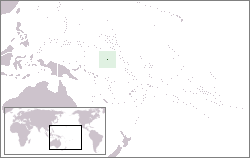
Location map for the Nauru.
Originally created for English Wikipedia by Vardion.
| |
This work has been released into the public domain by its author, Vardion, at the Linglänapük Vükiped project. This applies worldwide. In case this is not legally possible: |
Jenotem ragiva
Välolös däti/timi ad logön ragivi soäsä äbinon ün tim at.
| Dät/Tim | Magodil | Mafots | Geban | Küpet | |
|---|---|---|---|---|---|
| anuik | 22:47, 2010 yanul 27id | | 250 × 158 (3 KB) | Mahahahaneapneap | Compressed |
| 05:03, 2004 dekul 24id |  | 250 × 158 (6 KB) | EugeneZelenko | Location map for the Nauru.<br/>Originally created for English Wikipedia by Vardion.<br/>{{PD}}<br/>Category:Country locator maps |
Yüms
Pads sököl payümons ko pad at:
Ragivigeb Valöpik
The following other wikis use this file:
- Geb su af.wikipedia.org
- Geb su ar.wikipedia.org
- ناورو
- أيزو 3166-2:NR
- بوابة:ناورو
- بوابة:ناورو/واجهة
- معاملة المثليين في ناورو
- مستخدم:جار الله/قائمة صور مقالات العلاقات الثنائية
- العلاقات الأمريكية الناوروية
- العلاقات الأنغولية الناوروية
- العلاقات الكورية الجنوبية الناوروية
- العلاقات الإريترية الناوروية
- العلاقات السويسرية الناوروية
- العلاقات الألمانية الناوروية
- العلاقات الليختنشتانية الناوروية
- العلاقات البوليفية الناوروية
- العلاقات الموزمبيقية الناوروية
- العلاقات الألبانية الناوروية
- العلاقات البلجيكية الناوروية
- العلاقات الإثيوبية الناوروية
- العلاقات البيلاروسية الناوروية
- العلاقات الطاجيكستانية الناوروية
- العلاقات الروسية الناوروية
- العلاقات الرومانية الناوروية
- العلاقات الأرجنتينية الناوروية
- العلاقات الغامبية الناوروية
- العلاقات القبرصية الناوروية
- العلاقات السيراليونية الناوروية
- العلاقات الناوروية النيبالية
- العلاقات الليبيرية الناوروية
- العلاقات التشيكية الناوروية
- العلاقات الميانمارية الناوروية
- العلاقات الكندية الناوروية
- العلاقات العراقية الناوروية
- العلاقات البريطانية الناوروية
- العلاقات الكوبية الناوروية
- العلاقات الكورية الشمالية الناوروية
- العلاقات الكوستاريكية الناوروية
- العلاقات الكولومبية الناوروية
- العلاقات الكيريباتية الناوروية
- العلاقات الكينية الناوروية
- العلاقات اللاتفية الناوروية
- العلاقات اللاوسية الناوروية
- العلاقات اللبنانية الناوروية
- العلاقات اللوكسمبورغية الناوروية
- العلاقات الليبية الناوروية
- العلاقات الليتوانية الناوروية
- العلاقات الليسوتوية الناوروية
- العلاقات المالاوية الناوروية
- العلاقات المالطية الناوروية
- العلاقات المالية الناوروية
View more global usage of this file.