
Ragiv:Locator map Bavaria in Germany.svg

Size of this PNG preview of this SVG file: 443 × 599 pixels. Other resolutions: 177 × 240 pixels • 355 × 480 pixels • 567 × 768 pixels • 757 × 1,024 pixels • 1,513 × 2,048 pixels • 592 × 801 pixels.
Ragiv rigik (ragiv in fomät: SVG, magodaziöbs 592 × 801, gretot: 668 KB)
Plän brefik
.svg)
.svg)
.svg)
.svg)
.svg)
.svg)
.svg)

-en.svg)

.svg)
.svg)
.svg)

_(US48).svg)
_(small_islands_magnified)_(-mini_map_-rivers).svg)
.svg)
_(extra_close)_(US48).svg)
.svg)
_(zoom).svg)

.svg)


_(UNMIK).svg)
.svg)
_(disputed_hatched).svg)
_(claimed_and_disputed_hatched).svg)
.svg)
.svg)
_(%2Ball_claims_hatched).svg)

.svg)
_(shade).svg)
_(shade)_(special_marker).svg)
_(-mini_map).svg)
_(-mini_map).svg)
_(-mini_map).svg)


.svg)

.svg)
Dälastad
I, the copyright holder of this work, hereby publish it under the following licenses:

|
Däl pagevon ad kopiedön, seagivön e/u votükön dokümi at ma Dälazöt ad Dokümam Libik: GNU, Fomam: 1.2 u nulikum fa el Free Software Foundation (Stitod: Nünömaprograms libik); nen diläds nevotükovik, nen vödems tegapada balid, e leigo nen vödems tegapada lätik. Kopied dälazöta pekeninon in diläd: Dälazöt ad Dokümam Libik: GNU panemöl. |
This file is licensed under the Creative Commons Attribution-Share Alike 3.0 Unported, 2.5 Generic, 2.0 Generic and 1.0 Generic license.
- Binol libik:
- to share – to copy, distribute and transmit the work
- to remix – to adapt the work
- Under the following conditions:
- attribution – You must give appropriate credit, provide a link to the license, and indicate if changes were made. You may do so in any reasonable manner, but not in any way that suggests the licensor endorses you or your use.
- share alike – If you remix, transform, or build upon the material, you must distribute your contributions under the same or compatible license as the original.
You may select the license of your choice.
Jenotem ragiva
Välolös däti/timi ad logön ragivi soäsä äbinon ün tim at.
| Dät/Tim | Magodil | Mafots | Geban | Küpet | |
|---|---|---|---|---|---|
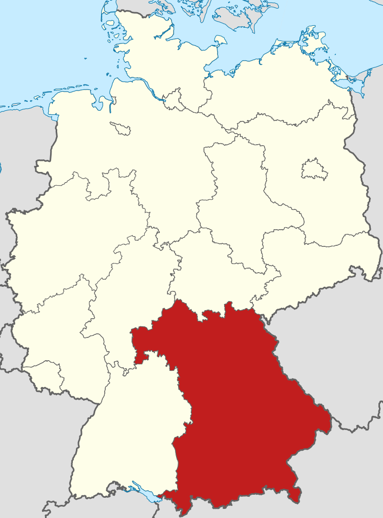
| anuik | 17:51, 2009 mäzul 11id | | 592 × 801 (668 KB) | TUBS | =={{int:filedesc}}== {{Information |Description= {{de|Lage von Bavaria in Deutschland}} {{en|Locator map of Bavaria in Germany.}} |Source= {{de|Eigene Arbeit}} {{en|Own work}} |Date=2009 |
Yüms
Pads sököl payümons ko pad at:
Ragivigeb Valöpik
The following other wikis use this file:
- Geb su af.wikipedia.org
- Geb su als.wikipedia.org
- Geb su ang.wikipedia.org
- Geb su ar.wikipedia.org
- Geb su ary.wikipedia.org
- Geb su arz.wikipedia.org
- Geb su ast.wikipedia.org
- Geb su ast.wiktionary.org
- Geb su ay.wikipedia.org
- Geb su az.wikipedia.org
- Geb su be-tarask.wikipedia.org
- Geb su be.wikipedia.org
- Geb su ca.wikipedia.org
- Geb su ceb.wikipedia.org
- Geb su crh.wikipedia.org
- Geb su csb.wikipedia.org
- Geb su cs.wikipedia.org
- Geb su da.wikipedia.org
- Naturpark Altmühltal
- Naturpark Frankenhöhe
- Naturpark Spessart
- Naturpark Augsburg-Westliche Wälder
- Naturpark Haßberge
- Naturpark Fichtelgebirge
- Naturpark Fränkische Schweiz-Veldensteiner Forst
- Geo-Naturpark Bergstraße-Odenwald
- Skabelon:Naturparker i Bayern
- Naturpark Bayerische Rhön
- Naturpark Frankenwald
- Naturpark Hirschwald
- Naturpark Nagelfluhkette
- Naturpark Nördlicher Oberpfälzer Wald
- Naturpark Oberer Bayerischer Wald
- Naturpark Oberpfälzer Wald
- Geb su de.wikipedia.org
View more global usage of this file.