
Ragiv:Map of New Mexico highlighting San Miguel County.svg

Ragiv rigik (ragiv in fomät: SVG, magodaziöbs 5,677 × 6,312, gretot: 31 KB)
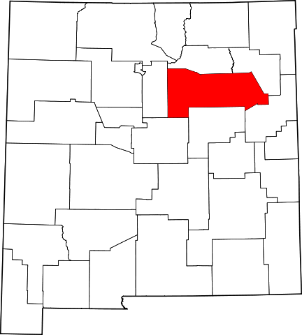
This is a locator map showing San Miguel County in New Mexico.
David Benbennick made this map. For more information, see Commons:United States county locator maps. Or see any of the New Mexico county locator maps: Bernalillo · Catron · Chaves · Cibola · Colfax · Curry · De Baca · Doña Ana · Eddy · Grant · Guadalupe · Harding · Hidalgo · Lea · Lincoln · Los Alamos · Luna · McKinley · Mora · Otero · Quay · Rio Arriba · Roosevelt · Sandoval · San Juan · San Miguel · Santa Fe · Sierra · Socorro · Taos · Torrance · Union · Valencia.
| I, the copyright holder of this work, release this work into the public domain. This applies worldwide. In some countries this may not be legally possible; if so: I grant anyone the right to use this work for any purpose, without any conditions, unless such conditions are required by law. |
Jenotem ragiva
Välolös däti/timi ad logön ragivi soäsä äbinon ün tim at.
| Dät/Tim | Magodil | Mafots | Geban | Küpet | |
|---|---|---|---|---|---|
| anuik | 15:31, 2006 febul 12id | | 5,677 × 6,312 (31 KB) | David Benbennick | {{subst:User:Dbenbenn/clm|county=San Miguel County|state=New Mexico|type=county}} |
Yüms
Pads nonik peyümons ad ragiv at.
Ragivigeb Valöpik
The following other wikis use this file:
- Geb su ar.wikipedia.org
- Geb su bg.wikipedia.org
- Geb su bpy.wikipedia.org
- Geb su cdo.wikipedia.org
- Geb su ceb.wikipedia.org
- Geb su ce.wikipedia.org
- Geb su cy.wikipedia.org
- Geb su de.wikipedia.org
- Geb su en.wikipedia.org
- List of counties in New Mexico
- San Miguel County, New Mexico
- Las Vegas, New Mexico
- Pecos, New Mexico
- Mosquero, New Mexico
- Trementina, New Mexico
- Villanueva, New Mexico
- Ribera, New Mexico
- Montezuma, New Mexico
- Template:San Miguel County, New Mexico
- User:Nyttend/County templates/NM
- Las Ruedas, New Mexico
- National Register of Historic Places listings in San Miguel County, New Mexico
- Rowe, New Mexico
- Category:Populated places in San Miguel County, New Mexico
- San Miguel del Vado, New Mexico
- Conchas Dam, New Mexico
- El Cerrito, New Mexico
- Canoncito, San Miguel County, New Mexico
- San Jose, San Miguel County, New Mexico
- Rociada, New Mexico
- Ilfeld, New Mexico
- Serafina, New Mexico
- Tererro, New Mexico
- Sapello, New Mexico
- Garita, New Mexico
- Holy Ghost, New Mexico
- Sena, New Mexico
- East Pecos, New Mexico
- North San Ysidro, New Mexico
- Pueblo, New Mexico
- Soham, New Mexico
View more global usage of this file.