
Ragiv:Map of South Carolina highlighting Horry County.svg

Size of this PNG preview of this SVG file: 752 × 599 pixels. Other resolutions: 301 × 240 pixels • 602 × 480 pixels • 964 × 768 pixels • 1,280 × 1,020 pixels • 2,560 × 2,040 pixels • 4,419 × 3,522 pixels.
Ragiv rigik (ragiv in fomät: SVG, magodaziöbs 4,419 × 3,522, gretot: 103 KB)
Plän brefik
| Bepenam |
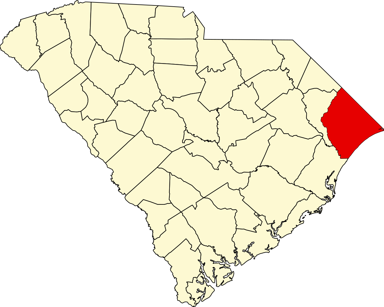
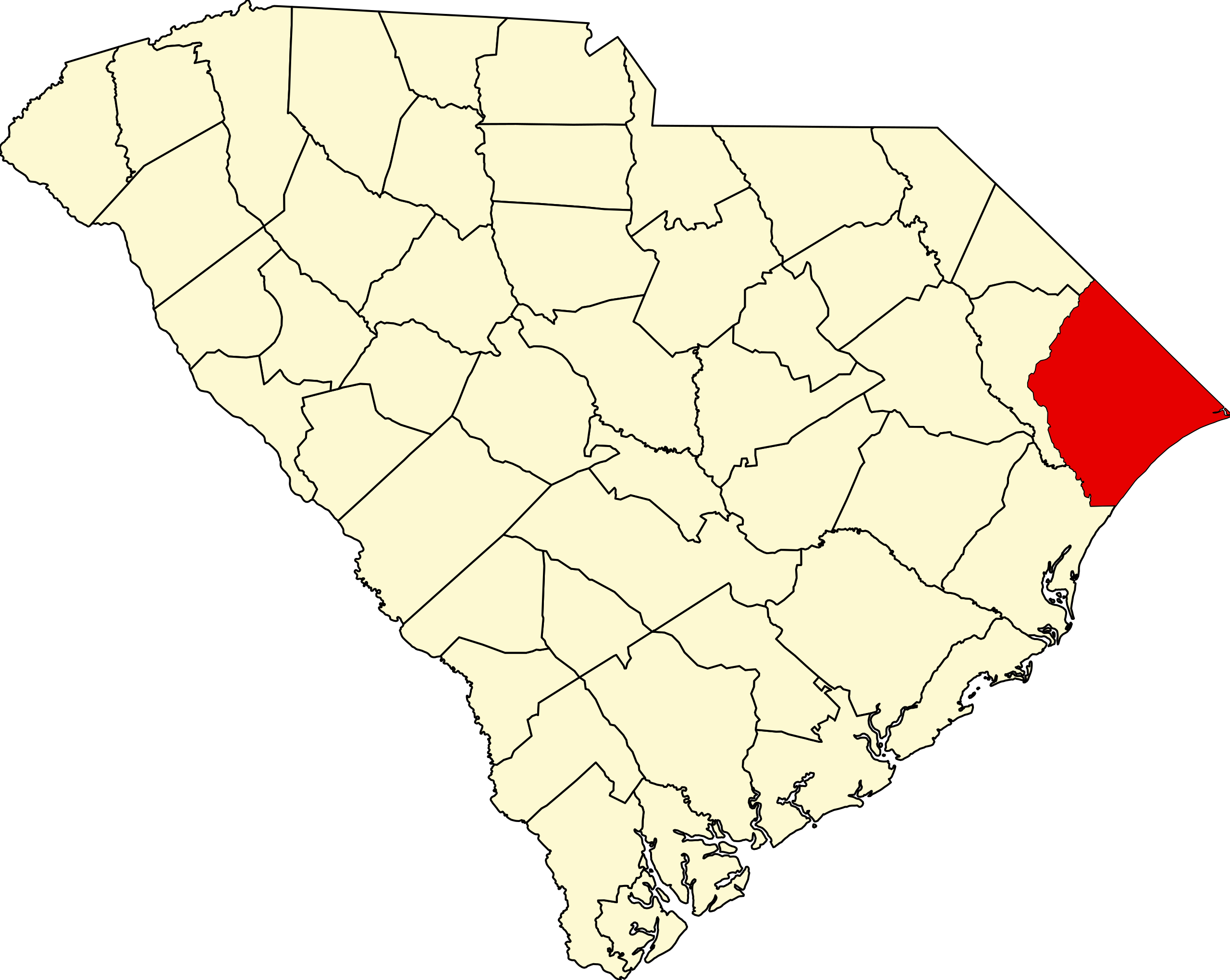
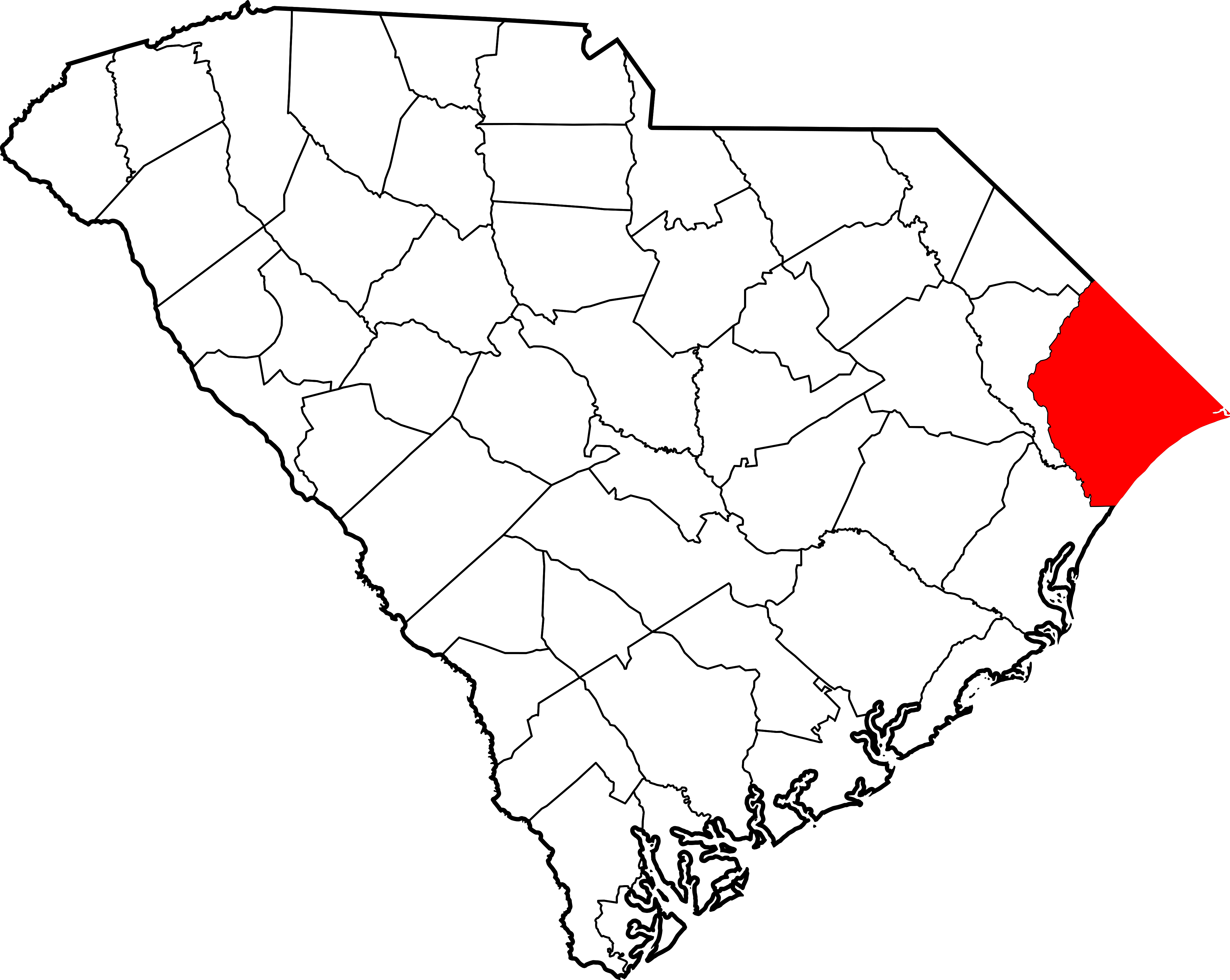
English: This is a locator map showing Horry County in South Carolina. For more information, see Commons:United States county locator maps. |
| Dät | |
| Fon |
Vobot okik: English: The maps use data from nationalatlas.gov, specifically countyp020.tar.gz on the Raw Data Download page. The maps also use state outline data from statesp020.tar.gz. The Florida maps use hydrogm020.tar.gz to display Lake Okeechobee. |
| Lautan | David Benbennick |
Dälastad
| I, the copyright holder of this work, release this work into the public domain. This applies worldwide. In some countries this may not be legally possible; if so: I grant anyone the right to use this work for any purpose, without any conditions, unless such conditions are required by law. |
Jenotem ragiva
Välolös däti/timi ad logön ragivi soäsä äbinon ün tim at.
| Dät/Tim | Magodil | Mafots | Geban | Küpet | |
|---|---|---|---|---|---|
| anuik | 16:25, 2006 febul 12id | | 4,419 × 3,522 (103 KB) | David Benbennick | {{subst:User:Dbenbenn/clm|county=Horry County|state=South Carolina|type=county}} |
Yüms
Pads nonik peyümons ad ragiv at.
Ragivigeb Valöpik
The following other wikis use this file:
- Geb su ar.wikipedia.org
- Geb su bg.wikipedia.org
- Geb su bpy.wikipedia.org
- Geb su cdo.wikipedia.org
- Geb su ceb.wikipedia.org
- Geb su ce.wikipedia.org
- Geb su cy.wikipedia.org
- Geb su de.wikipedia.org
- Geb su en.wikipedia.org
- List of counties in South Carolina
- Horry County, South Carolina
- Atlantic Beach, South Carolina
- Aynor, South Carolina
- Briarcliffe Acres, South Carolina
- Bucksport, South Carolina
- Conway, South Carolina
- Forestbrook, South Carolina
- Garden City, South Carolina
- Little River, South Carolina
- Loris, South Carolina
- Myrtle Beach, South Carolina
- North Myrtle Beach, South Carolina
- Red Hill, South Carolina
- Socastee, South Carolina
- Surfside Beach, South Carolina
- Myrtle Beach International Airport
- Pine Island, South Carolina
- Carolina Forest, South Carolina
- Homewood, South Carolina
- Horry County Schools
- Burgess, South Carolina
- Galivants Ferry, South Carolina
- Bucksville, South Carolina
- Socastee Historic District
- Template:Horry County, South Carolina
- Springmaid Beach, South Carolina
- Longs, South Carolina
View more global usage of this file.