
Ragiv:Panorama Niort.jpg
Size of this preview: 800 × 600 pixels. Other resolutions: 320 × 240 pixels • 640 × 480 pixels • 1,024 × 768 pixels • 1,280 × 960 pixels • 2,560 × 1,920 pixels • 3,648 × 2,736 pixels.
Ragiv rigik (3,648 × 2,736 pixel, ragivagret: 1.57 MB, pated MIME: image/jpeg)
Plän brefik
| Bepenam |
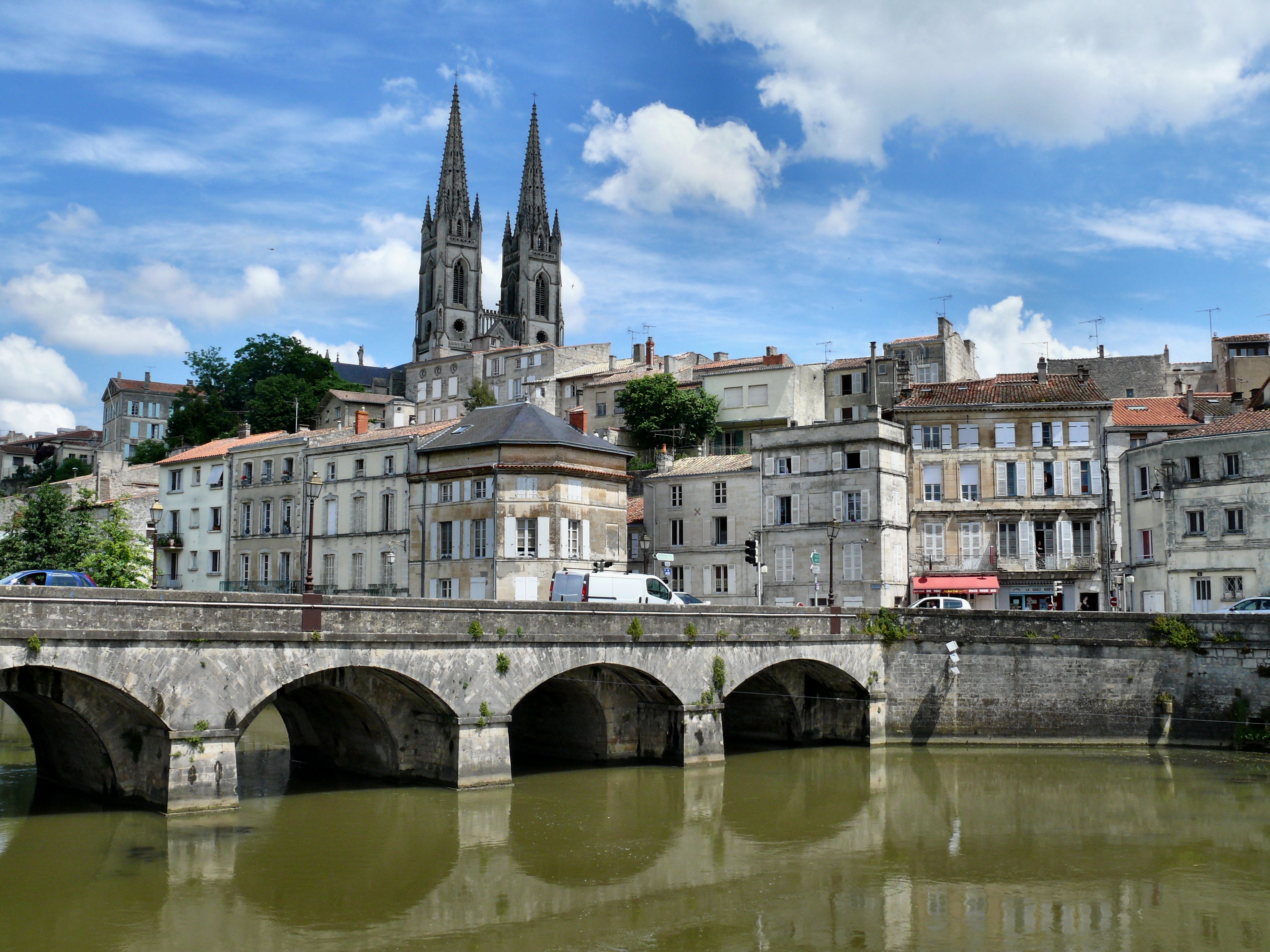
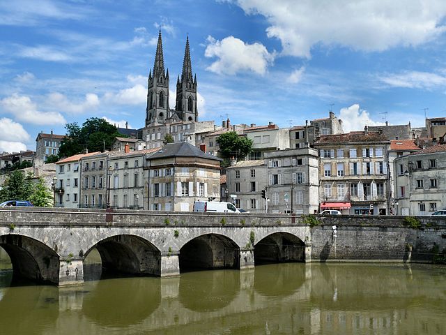
A view of Niort from the Sevre Niortaise river, Deux-Sevres, Poitou-Charentes region, France, May 2008 Une vue de Niort depuis la Sèvre Niortaise. Niort, Deux-Sèvres, région Poitou-Charentes, France, Mai 2008 |
| Dät | |
| Fon | Niort |
| Lautan | dynamosquito from France |
| Camera location | | View this and other nearby images on: OpenStreetMap |
|---|
Dälastad
This file is licensed under the Creative Commons Attribution-Share Alike 2.0 Generic license.
- Binol libik:
- to share – to copy, distribute and transmit the work
- to remix – to adapt the work
- Under the following conditions:
- attribution – You must give appropriate credit, provide a link to the license, and indicate if changes were made. You may do so in any reasonable manner, but not in any way that suggests the licensor endorses you or your use.
- share alike – If you remix, transform, or build upon the material, you must distribute your contributions under the same or compatible license as the original.
| This image was originally posted to Flickr by dynamosquito at https://www.flickr.com/photos/25182210@N07/2589020771. It was reviewed on 9 mäzul 2010 by FlickreviewR and was confirmed to be licensed under the terms of the cc-by-sa-2.0. |
Dälastad
This file is licensed under the Creative Commons Attribution 2.0 Generic license.
- Binol libik:
- to share – to copy, distribute and transmit the work
- to remix – to adapt the work
- Under the following conditions:
- attribution – You must give appropriate credit, provide a link to the license, and indicate if changes were made. You may do so in any reasonable manner, but not in any way that suggests the licensor endorses you or your use.
| This image was originally posted to Flickr by dynamosquito at https://www.flickr.com/photos/25182210@N07/2589020771. It was reviewed on 9 mäzul 2010 by FlickreviewR and was confirmed to be licensed under the terms of the cc-by-sa-2.0. |
Jenotem ragiva
Välolös däti/timi ad logön ragivi soäsä äbinon ün tim at.
| Dät/Tim | Magodil | Mafots | Geban | Küpet | |
|---|---|---|---|---|---|
| anuik | 07:54, 2010 mäzul 9id | | 3,648 × 2,736 (1.57 MB) | Cobber17 | {{Information |Description=A view of Niort from the Sevre Niortaise river, Deux-Sevres, Poitou-Charentes region, France, May 2008 Une vue de Niort depuis la Sèvre Niortaise. Niort, Deux-Sèvres, région Poitou-Charentes, France, Mai 2008 |Source=[http |
Yüms
Pads sököl payümons ko pad at:
Ragivigeb Valöpik
The following other wikis use this file:
- Geb su an.wikipedia.org
- Geb su ar.wikipedia.org
- Geb su arz.wikipedia.org
- Geb su avk.wikipedia.org
- Geb su az.wikipedia.org
- Geb su br.wikipedia.org
- Geb su ca.wikipedia.org
- Geb su ceb.wikipedia.org
- Geb su ce.wikipedia.org
- Geb su cs.wikipedia.org
- Geb su cv.wikipedia.org
- Geb su cy.wikipedia.org
- Geb su da.wikipedia.org
- Geb su de.wikipedia.org
- Geb su de.wikivoyage.org
- Geb su el.wikipedia.org
- Geb su en.wikipedia.org
- Geb su en.wikivoyage.org
- Geb su eo.wikipedia.org
- Geb su es.wikipedia.org
- Geb su et.wikipedia.org
- Geb su eu.wikipedia.org
- Geb su fr.wikipedia.org
- Geb su fr.wikinews.org
- Geb su fr.wikivoyage.org
- Geb su hak.wikipedia.org
- Geb su he.wikipedia.org
- Geb su hu.wikipedia.org
- Geb su hy.wikipedia.org
- Geb su it.wikipedia.org
- Geb su ja.wikipedia.org
- Geb su ja.wikivoyage.org
- Geb su la.wikipedia.org
View more global usage of this file.