
Ragiv:Santa Cruz County Incorporated and Unincorporated areas Rio Rico Northeast highlighted.svg

Size of this PNG preview of this SVG file: 800 × 424 pixels. Other resolutions: 320 × 169 pixels • 640 × 339 pixels • 1,024 × 542 pixels • 1,280 × 678 pixels • 2,560 × 1,355 pixels • 850 × 450 pixels.
Ragiv rigik (ragiv in fomät: SVG, magodaziöbs 850 × 450, gretot: 42 KB)
Plän brefik
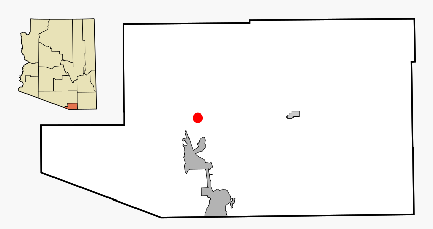
| Bepenam | This map shows the incorporated areas and unincorporated areas in Santa Cruz County, Arizona. Rio Rico Northeast is highlighted in red. Incorporated cities are shown in gray and unincorporated communities or CDPs are shown in white. Data for the borders and locations are based on files from the SouthEastern Arizona Governments Organization HPMS Maps and Records and maps from the US Census Bureau TIGER Map Server. I created this map in Inkscape. |
| Dät | |
| Fon | My own work, based on public domain information |
| Lautan | Ixnayonthetimmay |
| Däl (Reusing this file) |
All rights not reserved. See below. |
| Other versions | See Category:Maps of Santa Cruz County for other versions of this image. |
Dälastad
| I, the copyright holder of this work, release this work into the public domain. This applies worldwide. In some countries this may not be legally possible; if so: I grant anyone the right to use this work for any purpose, without any conditions, unless such conditions are required by law. |
Jenotem ragiva
Välolös däti/timi ad logön ragivi soäsä äbinon ün tim at.
| Dät/Tim | Magodil | Mafots | Geban | Küpet | |
|---|---|---|---|---|---|
| anuik | 02:58, 2007 mäzul 3id | | 850 × 450 (42 KB) | Ixnayonthetimmay | {{Information |Description=This map shows the incorporated areas and unincorporated areas in Santa Cruz County, Arizona. [[:en:Rio Rico Northeast, Arizona| |
Yüms
Pads nonik peyümons ad ragiv at.
Ragivigeb Valöpik
The following other wikis use this file:
- Geb su de.wikipedia.org
- Geb su sr.wikipedia.org