
Ragiv:Tarrant County Texas Incorporated Areas Southlake highlighted.svg

Size of this PNG preview of this SVG file: 800 × 436 pixels. Other resolutions: 320 × 175 pixels • 640 × 349 pixels • 1,024 × 559 pixels • 1,280 × 698 pixels • 2,560 × 1,396 pixels.
Ragiv rigik (ragiv in fomät: SVG, magodaziöbs 1,100 × 600, gretot: 235 KB)
Plän brefik
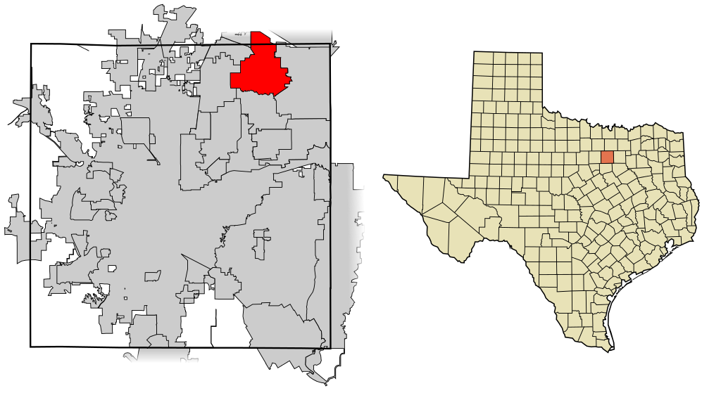
| Bepenam | This map shows the incorporated areas in Tarrant County, Texas. Southlake is highlighted in red. I created it in Inkscape using data from the following links: North Central Texas Council of Governments Maps Website, City of Fort Worth Interactive Zoning Map |
| Dät | |
| Fon | My own work, based on government information. Though I strove to be as accurate in the detail as possible, the information shown is not guaranteed to be completely accurate. |
| Lautan | Ixnayonthetimmay |
| Däl (Reusing this file) |
Public Domain |
| Other versions | See Category:Maps of Tarrant County, Texas for other versions of this image. |
Dälastad
| I, the copyright holder of this work, release this work into the public domain. This applies worldwide. In some countries this may not be legally possible; if so: I grant anyone the right to use this work for any purpose, without any conditions, unless such conditions are required by law. |
Jenotem ragiva
Välolös däti/timi ad logön ragivi soäsä äbinon ün tim at.
| Dät/Tim | Magodil | Mafots | Geban | Küpet | |
|---|---|---|---|---|---|
| anuik | 10:49, 2007 setul 4id | | 1,100 × 600 (235 KB) | Ixnayonthetimmay | == Summary == {{Information |Description=This map shows the incorporated areas in Tarrant County, Texas. Southlake is highlighted in red. I created it in [[en:Inksca |
Yüms
Pads sököl payümons ko pad at:
Ragivigeb Valöpik
The following other wikis use this file:
- Geb su ar.wikipedia.org
- Geb su arz.wikipedia.org
- Geb su ca.wikipedia.org
- Geb su cy.wikipedia.org
- Geb su de.wikipedia.org
- Geb su en.wikipedia.org
- Geb su eu.wikipedia.org
- Geb su fa.wikipedia.org
- Geb su fr.wikipedia.org
- Geb su ht.wikipedia.org
- Geb su it.wikipedia.org
- Geb su no.wikipedia.org
- Geb su sr.wikipedia.org
- Geb su tt.wikipedia.org
- Geb su vi.wikipedia.org
- Geb su www.wikidata.org