
Ragiv:Waremme Liège Belgium Map.png
Gretot gudikum no pagebidon.
Waremme_Liège_Belgium_Map.png (290 × 220 pixel, ragivagret: 7 KB, pated MIME: image/png)
| Bepenam |
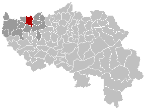
English: Map, municipality belgium Waremme
Français : Carte indiquant la localisation de la commune de Waremme dans la Province de Liège. |
|||
| Fon | Vobot okik | |||
| Lautan | LennartBolks | |||
| Däl (Reusing this file) |
PD | |||
| Other versions |
|


| This work has been released into the public domain by its author, LennartBolks. This applies worldwide. In some countries this may not be legally possible; if so: |
Jenotem ragiva
Välolös däti/timi ad logön ragivi soäsä äbinon ün tim at.
| Dät/Tim | Magodil | Mafots | Geban | Küpet | |
|---|---|---|---|---|---|
| anuik | 14:43, 2007 mäzul 2id | | 290 × 220 (7 KB) | Siebrand | Updateed version from nl:Afbeelding:BorgwormLocatie.png by User:Westermarck |
| 21:42, 2005 prilul 4id |  | 290 × 220 (5 KB) | Nicnac25~commonswiki | Map, municipality belgium Waremme {{PD}} FR; Carte indiquant la localisation de la commune de Waremme dans la Province de Liège. EN; Map from w:nl:Gebruiker:LennartBolks/kaartenhoekje in Public Domain by the Author choice. [[Category:Maps of provin |
Yüms
Pads nonik peyümons ad ragiv at.