
Ragiv:ALMap-doton-BurningtreeMountain.png
Gretot gudikum no pagebidon.
ALMap-doton-BurningtreeMountain.png (201 × 300 pixel, ragivagret: 13 KB, pated MIME: image/png)
Plän brefik

|
This locator map image could be re-created using vector graphics as an SVG file. This has several advantages; see Commons:Media for cleanup for more information. If an SVG form of this image is available, please upload it and afterwards replace this template with
{{vector version available|new image name}}.
It is recommended to name the SVG file “ALMap-doton-BurningtreeMountain.svg”—then the template Vector version available (or Vva) does not need the new image name parameter. |
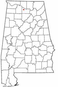
| Bepenam | Dot map of en:Burningtree Mountain, Alabama subdivision of en:Decatur, Alabama. |
| Dät | 1 novul 2006 (original upload date) |
| Fon | Transferred from en.wikipedia to Commons. |
| Lautan | AlabamaGuy2007 at Linglänapük Vükiped |
Dälastad
| This work has been released into the public domain by its author, AlabamaGuy2007 at Linglänapük Vükiped. This applies worldwide. In some countries this may not be legally possible; if so: AlabamaGuy2007 grants anyone the right to use this work for any purpose, without any conditions, unless such conditions are required by law. |
Original upload log
The original description page was here. All following user names refer to en.wikipedia.
- 2006-11-01 02:21 AlabamaGuy2007 201×300×8 (12978 bytes) Dot map of [[Burningtree Mountain, Alabama]] subdivision of [[Decatur, Alabama]].
Jenotem ragiva
Välolös däti/timi ad logön ragivi soäsä äbinon ün tim at.
| Dät/Tim | Magodil | Mafots | Geban | Küpet | |
|---|---|---|---|---|---|
| anuik | 14:36, 2007 yunul 22id | | 201 × 300 (13 KB) | Smeira | {{Information |Description=Dot map of en:Burningtree Mountain, Alabama subdivision of en:Decatur, Alabama. |Source=Originally from [http://en.wikipedia.org en.wikipedia]; description page is/was [http://en.wikipedia.org/w/index.php?title=Image%3 |
Yüms
Pads nonik peyümons ad ragiv at.
Ragivigeb Valöpik
The following other wikis use this file:
- Geb su cy.wikipedia.org
- Geb su ht.wikipedia.org
- Geb su www.wikidata.org