
Ragiv:Cosne-Cours-sur-Loire - Pont et vol d'oiseaux.jpg

Size of this preview: 800 × 600 pixels. Other resolutions: 320 × 240 pixels • 640 × 480 pixels • 1,024 × 768 pixels • 1,280 × 960 pixels • 2,560 × 1,920 pixels.
Ragiv rigik (2,560 × 1,920 pixel, ragivagret: 1,005 KB, pated MIME: image/jpeg)
Plän brefik
| Bepenam |
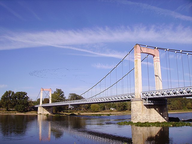
English: Bridge (upstream side) over the Loire River in Cosne-Cours-sur-Loire and cranes in flight, Nièvre, Burgundy, France.
Français : Pont routier (côté amont, vu de la rive droite) franchissant la Loire à Cosne-Cours-sur-Loire et migration de grues cendrées. Nièvre, Bourgogne, France. |
| Dät | |
| Fon | Vobot okik |
| Lautan | Cjp24 |
| Other versions |
.jpg) |
| Object location | | View this and other nearby images on: OpenStreetMap |
|---|
Dälastad
I, the copyright holder of this work, hereby publish it under the following licenses:

|
Däl pagevon ad kopiedön, seagivön e/u votükön dokümi at ma Dälazöt ad Dokümam Libik: GNU, Fomam: 1.2 u nulikum fa el Free Software Foundation (Stitod: Nünömaprograms libik); nen diläds nevotükovik, nen vödems tegapada balid, e leigo nen vödems tegapada lätik. Kopied dälazöta pekeninon in diläd: Dälazöt ad Dokümam Libik: GNU panemöl. |
This file is licensed under the Creative Commons Attribution-Share Alike 3.0 Unported, 2.5 Generic, 2.0 Generic and 1.0 Generic license.
- Binol libik:
- to share – to copy, distribute and transmit the work
- to remix – to adapt the work
- Under the following conditions:
- attribution – You must give appropriate credit, provide a link to the license, and indicate if changes were made. You may do so in any reasonable manner, but not in any way that suggests the licensor endorses you or your use.
- share alike – If you remix, transform, or build upon the material, you must distribute your contributions under the same or compatible license as the original.
You may select the license of your choice.
| Annotations | This image is annotated: View the annotations at Commons |
Jenotem ragiva
Välolös däti/timi ad logön ragivi soäsä äbinon ün tim at.
| Dät/Tim | Magodil | Mafots | Geban | Küpet | |
|---|---|---|---|---|---|
| anuik | 02:11, 2013 mäzul 2id | | 2,560 × 1,920 (1,005 KB) | Cjp24 | {{Information |Description ={{en|1=Bridge (upstream side) over the Loire River in Cosne-Cours-sur-Loire and cranes in flight, Nièvre, Burgundy, France.}} {{fr|1=Pont routier (... |
Yüms
Pads sököl payümons ko pad at:
Ragivigeb Valöpik
The following other wikis use this file:
- Geb su eo.wikipedia.org
- Geb su fr.wikipedia.org
- Geb su mg.wikipedia.org
- Geb su oc.wikipedia.org
- Geb su pt.wikipedia.org
- Geb su ru.wikipedia.org
- Geb su zh-min-nan.wikipedia.org