
Ragiv:Karte Deutschland.svg

Size of this PNG preview of this SVG file: 443 × 599 pixels. Other resolutions: 177 × 240 pixels • 355 × 480 pixels • 567 × 768 pixels • 757 × 1,024 pixels • 1,513 × 2,048 pixels • 592 × 801 pixels.
Ragiv rigik (ragiv in fomät: SVG, magodaziöbs 592 × 801, gretot: 208 KB)
| Bepenam |
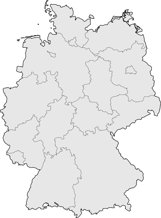
Deutsch: Karte der Bundesrepublik Deutschland mit den Grenzen der 16 Bundesländer.
English: Map of Germany with the borders of the 16 federal states.
|
| Dät | |
| Fon | Based on Image:Karte Deutsche Bundesländer (nummeriert).svg, color scheme of Image:Karte Deutschland.png applied. |
| Lautan | David Liuzzo |
| Däl (Reusing this file) |
This file is licensed under the Creative Commons Attribution-Share Alike 2.0 Germany license.
 |
| Other versions |
Derivative works of this file:
|
| SVG genesis | This map was created with Adobe Illustrator, with Sodipodi |


.svg)
Jenotem ragiva
Välolös däti/timi ad logön ragivi soäsä äbinon ün tim at.
| Dät/Tim | Magodil | Mafots | Geban | Küpet | |
|---|---|---|---|---|---|
| anuik | 08:51, 2008 mäzul 18id | | 592 × 801 (208 KB) | TMg | Border lines a little bit darker so they are equal when viewing both images in the same size, e.g. 140px. |
| 20:34, 2007 gustul 20id |  | 592 × 801 (209 KB) | Kjunix | {{Information| |Description= {{de|Karte der Bundesrepublik Deutschland mit eingezeichneten Grenzen der Bundesländer.}} |Source=based on Karte Deutsche Bundesländer (nummeriert).svg, color schem |
.svg)
Yüms
Pads plu 100 labons yümi lü ragiv at. Lised dono jonon padayümis balid 100 te lü ragiv at. Lised lölöfik gebidon.
- Aachen
- Ahrensburg
- Aschersleben
- Augsburg
- Bautzen
- Bergisch Gladbach
- Bernburg
- Bielefeld
- Bochum
- Bonn
- Bottrop
- Braunschweig
- Bremen
- Bremerhaven
- Celle
- Chemnitz
- Cottbus
- Darmstadt
- Delmenhorst
- Dillenburg
- Dortmund
- Dresden
- Duisburg
- Eberswalde
- Eisenhüttenstadt
- Elmshorn
- Emden
- Erfurt
- Erlangen
- Flensburg
- Frankfurt len Oder
- Freiburg (Badän)
- Fulda
- Geesthacht
- Gelsenkirchen
- Greifswald
- Görlitz
- Göttingen
- Halberstadt
- Hamburg
- Hannover
- Heidelberg
- Heilbronn
- Henstedt-Ulzburg
- Hildesheim
- Hoyerswerda
- Ingolstadt
- Itzehoe
- Jülich
- Karlsruhe
- Kassel
- Kiel
- Krefeld
- Köthen
- Leipzig
- Leverkusen
- Ludwigsburg
- Lübeck
- Lüneburg
- Magdeburg
- Mainz
- Mannheim
- Marburg
- Meißen
- Merseburg
- Mönchengladbach
- Neubrandenburg
- Neuruppin
- Norderstedt
- Nürnberg
- Osnabrück
- Paderborn
- Pforzheim
- Pinneberg
- Potsdam
- Quedlinburg
- Recklinghausen
- Regensburg
- Reinbek
- Remscheid
- Rendsburg
- Reutlingen
- Rostock
- Saarbrücken
- Salzgitter
- Schleswig
- Schwerin
- Solingen
- Stralsund
- Stuttgart
- Tübingen
- Ulm
- Wedel
- Wesel
- Wetzlar
- Wiesbaden
- Wilhelmshaven
- Wismar
- Wolfsburg
- Wuppertal
Logolös yümis pluik ad ragiv at.