
Ragiv:Maracanaú.jpg

Size of this preview: 800 × 429 pixels. Other resolutions: 320 × 172 pixels • 640 × 343 pixels • 1,024 × 549 pixels • 1,280 × 686 pixels • 3,224 × 1,728 pixels.
Ragiv rigik (3,224 × 1,728 pixel, ragivagret: 973 KB, pated MIME: image/jpeg)
Plän brefik
| Bepenam |
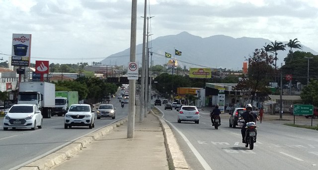
English: View from the Mendel Steinbruch Avenue (a stretch of CE-060 Highway) Viaduct over the Fortaleza Ring Road towards Maracanaú. In the background, can be seen several companies, two large Brazilian flags and the Aratanha mountain range. Separated by the road, on the right, Industrial District, and on the left, Pajuçara. Maracanaú, Ceará, Brazil.
Português: Vista a partir do viaduto da avenida Mendel Steinbruch (um trecho da rodovia CE-060) sobre o Anel Viário em direção a Maracanaú. Ao fundo, ver-se várias empresas, duas grandes bandeiras do Brasil hasteadas e a serra da Aratanha. Separados pela via, à direita, Distrito Industrial, e à esquerda, Pajuçara. Maracanaú, Ceará, Brasil. |
| Dät | |
| Fon | Vobot okik |
| Lautan | Porto Neto |
| Camera location | | View this and other nearby images on: OpenStreetMap |
|---|
Dälastad
I, the copyright holder of this work, hereby publish it under the following license:
This file is licensed under the Creative Commons Attribution-Share Alike 4.0 International license.
- Binol libik:
- to share – to copy, distribute and transmit the work
- to remix – to adapt the work
- Under the following conditions:
- attribution – You must give appropriate credit, provide a link to the license, and indicate if changes were made. You may do so in any reasonable manner, but not in any way that suggests the licensor endorses you or your use.
- share alike – If you remix, transform, or build upon the material, you must distribute your contributions under the same or compatible license as the original.
Jenotem ragiva
Välolös däti/timi ad logön ragivi soäsä äbinon ün tim at.
| Dät/Tim | Magodil | Mafots | Geban | Küpet | |
|---|---|---|---|---|---|
| anuik | 13:46, 2023 yanul 10id | | 3,224 × 1,728 (973 KB) | Porto Neto | Adjustments. |
| 02:09, 2023 yanul 10id |  | 3,540 × 1,548 (965 KB) | Porto Neto | Adjustments. | |
| 02:05, 2023 yanul 10id |  | 4,160 × 3,120 (1.96 MB) | Porto Neto | Uploaded own work with UploadWizard |
Yüms
Pads sököl payümons ko pad at:
Ragivigeb Valöpik
The following other wikis use this file:
- Geb su ar.wikipedia.org
- Geb su ceb.wikipedia.org
- Geb su ce.wikipedia.org
- Geb su en.wikipedia.org
- Geb su eo.wikipedia.org
- Geb su es.wikipedia.org
- Geb su eu.wikipedia.org
- Geb su it.wikipedia.org
- Geb su no.wikipedia.org
- Geb su pt.wikipedia.org
- Geb su ro.wikipedia.org
- Geb su ru.wikipedia.org
- Geb su tt.wikipedia.org
- Geb su www.wikidata.org