
Ragiv:Springboro and Clearcreek Township.jpg
Size of this preview: 800 × 600 pixels. Other resolutions: 320 × 240 pixels • 640 × 480 pixels • 1,024 × 768 pixels • 1,280 × 960 pixels • 2,272 × 1,704 pixels.
Ragiv rigik (2,272 × 1,704 pixel, ragivagret: 1.58 MB, pated MIME: image/jpeg)
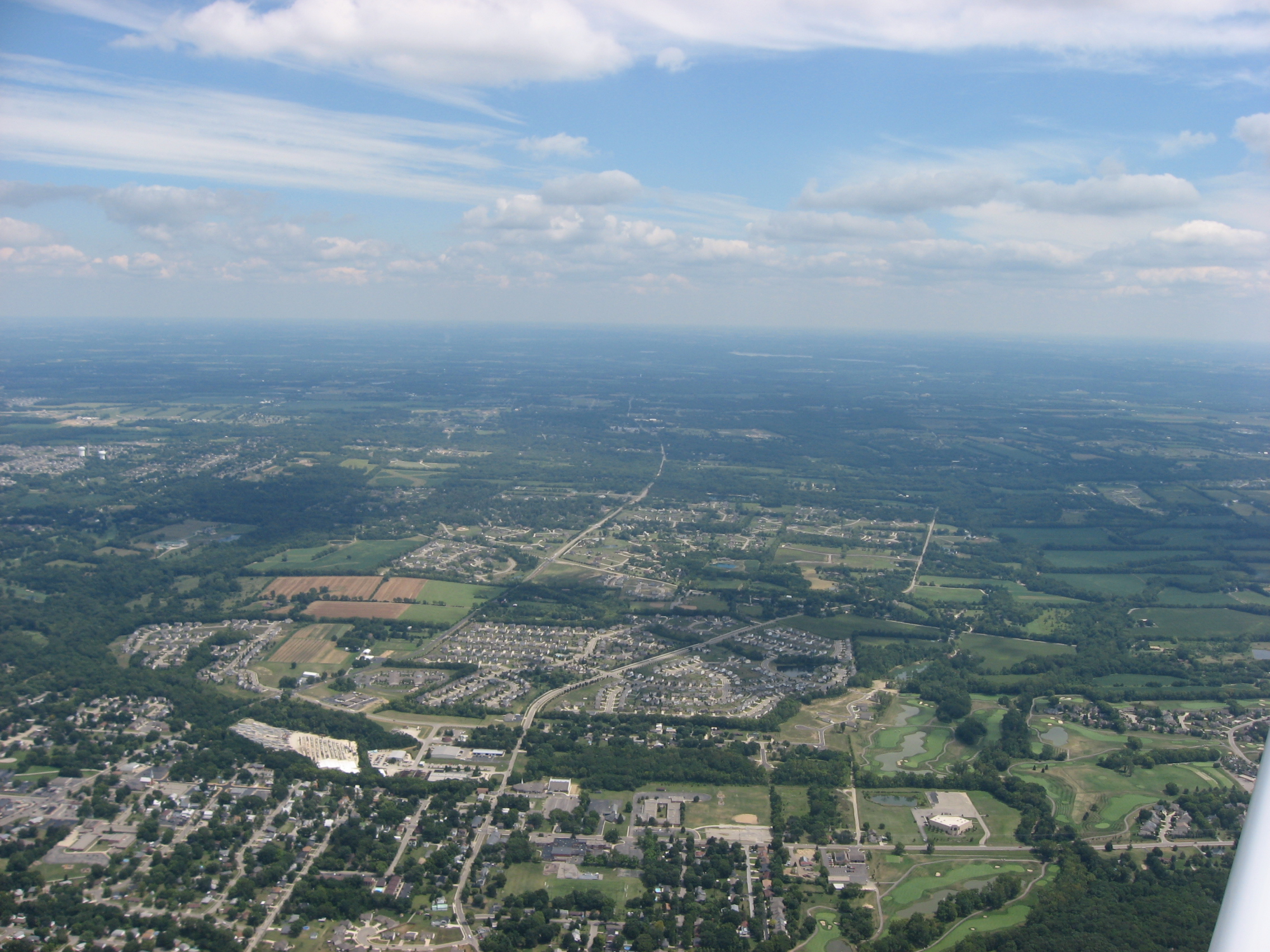
| Bepenam | Aerial view of Springboro, a city primarily in Warren County, Ohio, United States; although part of the city extends into Montgomery County, this picture is taken exclusively over Warren County. Heatherwoode Golf Club is visible on the right side of the picture. Picture taken from a Diamond Eclipse light airplane at an altitude of 3,440 feet MSL and a bearing of approximately 95º. | ||
| Dät | Taken on 12 gustul 2008 | ||
| Fon | Vobot okik | ||
| Lautan | Nyttend | ||
| Däl (Reusing this file) |
|
Jenotem ragiva
Välolös däti/timi ad logön ragivi soäsä äbinon ün tim at.
| Dät/Tim | Magodil | Mafots | Geban | Küpet | |
|---|---|---|---|---|---|
| anuik | 02:16, 2008 setul 23id | | 2,272 × 1,704 (1.58 MB) | Nyttend | {{Information |Description=Aerial view of {{w|Springboro, Ohio|Springboro}}, a city primarily in {{w|Warren County, Ohio|Warren County}}, {{w|Ohio}}, {{w|United States}}; although part of the city extends into {{w|Montgomery County, Ohio|Montgomery County |
Yüms
Pads sököl payümons ko pad at:
Ragivigeb Valöpik
The following other wikis use this file:
- Geb su ar.wikipedia.org
- Geb su arz.wikipedia.org
- Geb su azb.wikipedia.org
- Geb su ca.wikipedia.org
- Geb su ceb.wikipedia.org
- Geb su ce.wikipedia.org
- Geb su cy.wikipedia.org
- Geb su en.wikipedia.org
- Geb su en.wikivoyage.org
- Geb su es.wikipedia.org
- Geb su eu.wikipedia.org
- Geb su fa.wikipedia.org
- Geb su fr.wikipedia.org
- Geb su ht.wikipedia.org
- Geb su it.wikipedia.org
- Geb su it.wikivoyage.org
- Geb su ky.wikipedia.org
- Geb su lld.wikipedia.org
- Geb su pl.wikipedia.org
- Geb su pt.wikipedia.org
- Geb su sh.wikipedia.org
- Geb su sr.wikipedia.org
- Geb su tr.wikipedia.org
- Geb su tt.wikipedia.org
- Geb su uk.wikipedia.org
- Geb su uz.wikipedia.org
- Geb su vi.wikipedia.org
- Geb su www.wikidata.org
- Geb su zh-min-nan.wikipedia.org
- Geb su zh.wikipedia.org