
Ragiv:LA County Incorporated Areas Rosemead highlighted.svg

Size of this PNG preview of this SVG file: 730 × 599 pixels. Votik(s) magodadensitöfs: 292 × 240 pixels • 585 × 480 pixels • 935 × 768 pixels • 1,247 × 1,024 pixels • 2,494 × 2,048 pixels • 950 × 780 pixels.
Ragiv rigik (ragiv in fomät: SVG, magodaziöbs 950 × 780, gretot: 262 KB)
Plän brefik
| Bepenam |
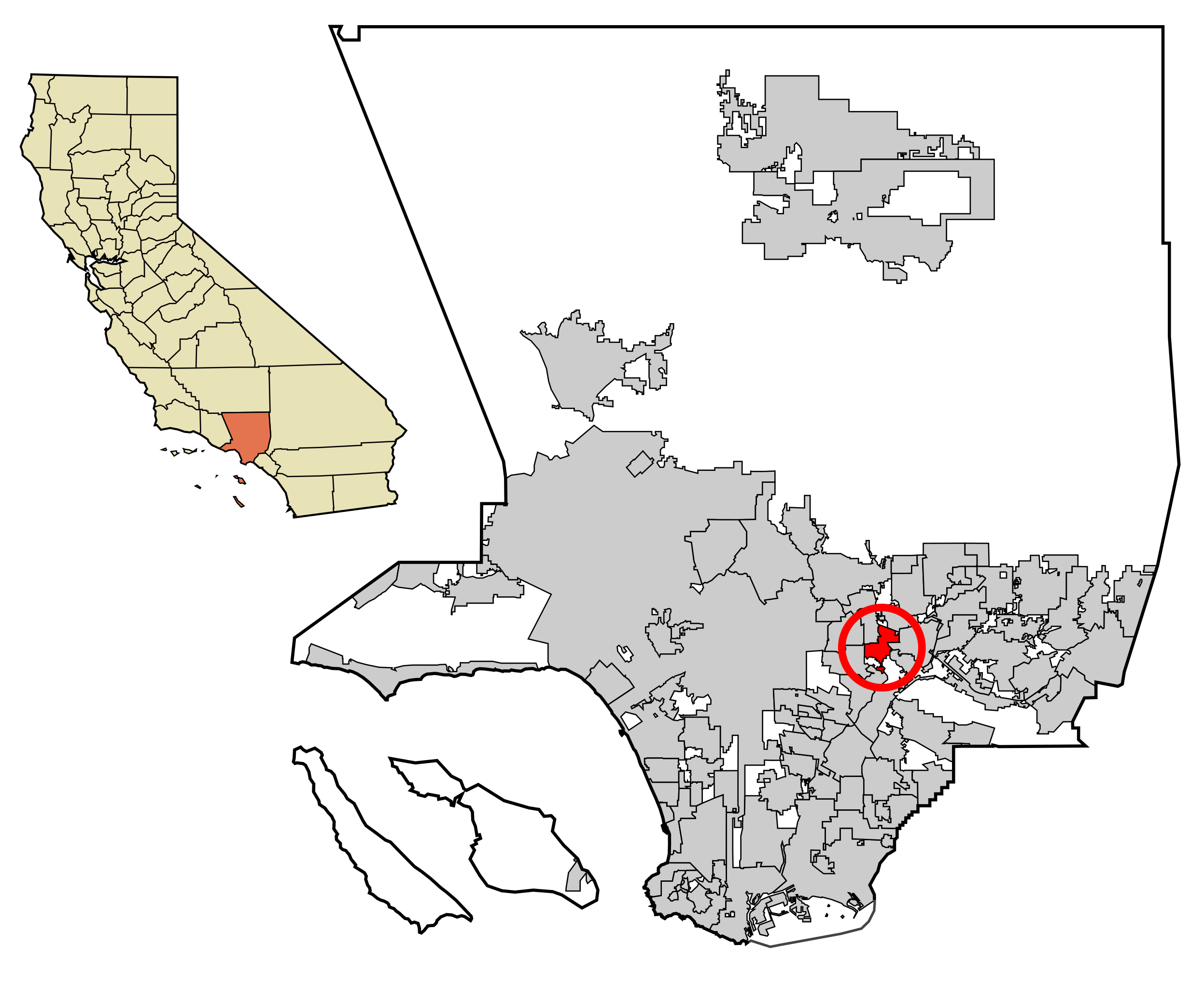
This map shows the incorporated areas in Los Angeles County, California.
|
| Dät | |
| Fon | My own work, based on public domain information. Though I strove to be as accurate in the detail as possible, the information shown is not guaranteed to be completely accurate. |
| Lautan | Ixnayonthetimmay |
| Däl (Dönugebön nünedi at) |
Public Domain |
| Other versions | See Category:Maps of Los Angeles County for other versions of this image. |
Dälastad
| I, the copyright holder of this work, release this work into the public domain. This applies worldwide. In some countries this may not be legally possible; if so: I grant anyone the right to use this work for any purpose, without any conditions, unless such conditions are required by law. |
Jenotem ragiva
Välolös däti/timi ad logön ragivi soäsä äbinon ün tim at.
| Dät/Tim | Magodil | Mafots | Geban | Küpet | |
|---|---|---|---|---|---|
| anuik | 05:18, 2007 yunul 29id | | 950 × 780 (262 KB) | Ixnayonthetimmay | == Summary == {{Information |Description=This map shows the incorporated areas in Los Angeles County, California. Rosemead is highlighted in red. I |
Yüms
Pads sököl payümons ko pad at:
Ragivigeb Valöpik
Proyegs votik sököl di ‚wiki’ gebons nünedi at:
- Geb su ar.wikipedia.org
- Geb su arz.wikipedia.org
- Geb su azb.wikipedia.org
- Geb su ca.wikipedia.org
- Geb su ceb.wikipedia.org
- Geb su en.wikipedia.org
- Geb su eo.wikipedia.org
- Geb su es.wikipedia.org
- Geb su eu.wikipedia.org
- Geb su fa.wikipedia.org
- Geb su fr.wikipedia.org
- Geb su ht.wikipedia.org
- Geb su hu.wikipedia.org
- Geb su it.wikipedia.org
- Geb su ja.wikipedia.org
- Geb su ko.wikipedia.org
- Geb su ml.wikipedia.org
- Geb su mzn.wikipedia.org
- Geb su no.wikipedia.org
- Geb su pt.wikipedia.org
- Geb su ro.wikipedia.org
- Geb su ru.wikipedia.org
- Geb su simple.wikipedia.org
- Geb su sr.wikipedia.org
- Geb su sw.wikipedia.org
- Geb su tr.wikipedia.org
- Geb su tt.wikipedia.org
- Geb su ur.wikipedia.org
- Geb su vi.wikipedia.org
- Geb su www.wikidata.org
- Geb su zh-min-nan.wikipedia.org
- Geb su zh.wikipedia.org