
Ragiv:Brighton and Hove UK locator map.svg

Size of this PNG preview of this SVG file: 800 × 521 pixels. Other resolutions: 320 × 208 pixels • 640 × 417 pixels • 1,024 × 667 pixels • 1,280 × 834 pixels • 2,560 × 1,667 pixels • 1,425 × 928 pixels.
Ragiv rigik (ragiv in fomät: SVG, magodaziöbs 1,425 × 928, gretot: 787 KB)
| Bepenam |
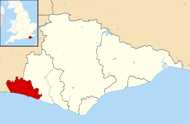
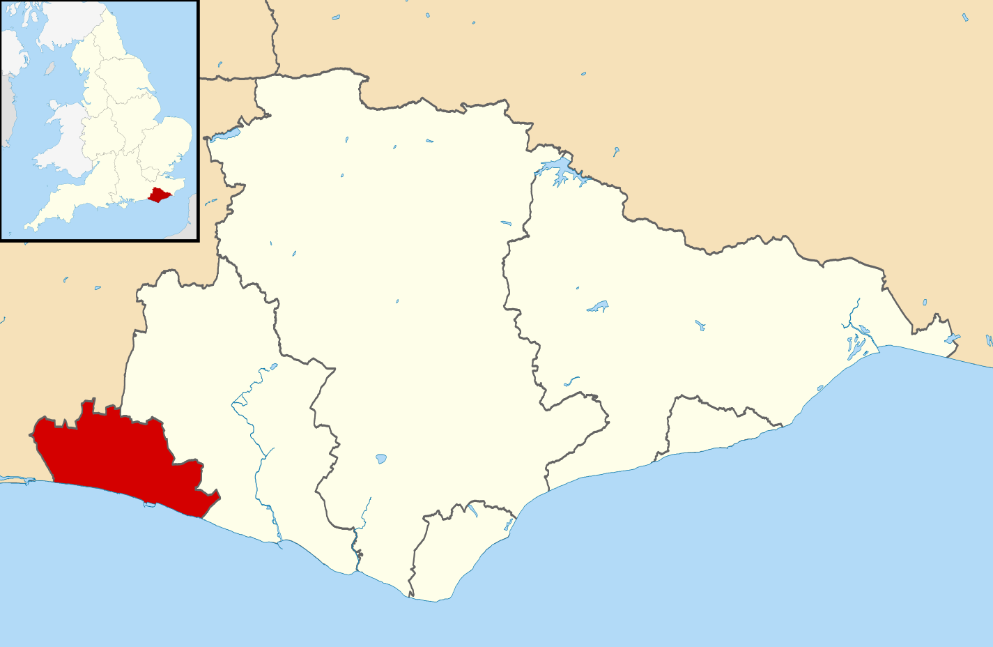
Map of East Sussex, UK with Brighton and Hove highlighted. Equirectangular map projection on WGS 84 datum, with N/S stretched 155% |
| Dät | |
| Fon |
|
| Lautan | Nilfanion, created using Ordnance Survey data |
| Däl (Reusing this file) |
This file is licensed under the Creative Commons Attribution-Share Alike 3.0 Unported license. Attribution: Contains Ordnance Survey data © Crown copyright and database right
|
Jenotem ragiva
Välolös däti/timi ad logön ragivi soäsä äbinon ün tim at.
| Dät/Tim | Magodil | Mafots | Geban | Küpet | |
|---|---|---|---|---|---|
| anuik | 11:32, 2011 mäzul 10id | | 1,425 × 928 (787 KB) | Nilfanion | {{Information |Description=Map of East Sussex, UK with Brighton and Hove highlighted. Equirectangular map projection on WGS 84 datum, with N/S stretched 155% |Source=Ordnance Survey [https:/ |
Yüms
Pads sököl payümons ko pad at:
Ragivigeb Valöpik
The following other wikis use this file:
- Geb su ar.wikipedia.org
- Geb su arz.wikipedia.org
- Geb su ast.wikipedia.org
- Geb su azb.wikipedia.org
- Geb su cy.wikipedia.org
- Geb su diq.wikipedia.org
- Geb su en.wikipedia.org
- Geb su es.wikipedia.org
- Geb su eu.wikipedia.org
- Geb su fa.wikipedia.org
- Geb su fi.wikipedia.org
- Geb su frr.wikipedia.org
- Geb su ga.wikipedia.org
- Geb su ja.wikipedia.org
- Geb su ko.wikipedia.org
- Geb su mk.wikipedia.org
- Geb su mzn.wikipedia.org
- Geb su nl.wikipedia.org
- Geb su no.wikipedia.org
- Geb su pl.wikipedia.org
- Geb su pnb.wikipedia.org
- Geb su pt.wikipedia.org
- Geb su ro.wikipedia.org
- Geb su ru.wikipedia.org
- Geb su sv.wikipedia.org
- Geb su th.wikipedia.org
- Geb su tr.wikipedia.org
- Geb su ur.wikipedia.org
- Geb su www.wikidata.org
- Geb su zh-min-nan.wikipedia.org
- Geb su zh-yue.wikipedia.org
- Geb su zh.wikipedia.org