
Ragiv:Bristol UK locator map 2010.svg

Size of this PNG preview of this SVG file: 494 × 600 pixels. Other resolutions: 198 × 240 pixels • 395 × 480 pixels • 633 × 768 pixels • 843 × 1,024 pixels • 1,687 × 2,048 pixels • 1,108 × 1,345 pixels.
Ragiv rigik (ragiv in fomät: SVG, magodaziöbs 1,108 × 1,345, gretot: 302 KB)
Plän brefik
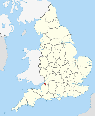
| Bepenam | Location of the ceremonial county of Bristol within England. |
| Dät | |
| Fon |
National Geospatial-Intelligence Agency
|
| Lautan | Nilfanion |
Dälastad
I, the copyright holder of this work, hereby publish it under the following licenses:
This file is licensed under the Creative Commons Attribution-Share Alike 3.0 Unported license.
- Binol libik:
- to share – to copy, distribute and transmit the work
- to remix – to adapt the work
- Under the following conditions:
- attribution – You must give appropriate credit, provide a link to the license, and indicate if changes were made. You may do so in any reasonable manner, but not in any way that suggests the licensor endorses you or your use.
- share alike – If you remix, transform, or build upon the material, you must distribute your contributions under the same or compatible license as the original.

|
Däl pagevon ad kopiedön, seagivön e/u votükön dokümi at ma Dälazöt ad Dokümam Libik: GNU, Fomam: 1.2 u nulikum fa el Free Software Foundation (Stitod: Nünömaprograms libik); nen diläds nevotükovik, nen vödems tegapada balid, e leigo nen vödems tegapada lätik. Kopied dälazöta pekeninon in diläd: Dälazöt ad Dokümam Libik: GNU panemöl. |
You may select the license of your choice.

|
This is one of the images forming part of the Valued image set: Locator maps of the Ceremonial counties of England on Wikimedia Commons. The image set has been assessed under the valued image set criteria and is considered the most valued set on Commons within the scope:
Locator maps of the Ceremonial counties of England
You can see its nomination at Commons:Valued image candidates/Locator maps of English ceremonial counties. |
Jenotem ragiva
Välolös däti/timi ad logön ragivi soäsä äbinon ün tim at.
| Dät/Tim | Magodil | Mafots | Geban | Küpet | |
|---|---|---|---|---|---|
| anuik | 22:30, 2010 novul 23id | | 1,108 × 1,345 (302 KB) | Nilfanion | == Summary == {{Information |Description=Location of the ceremonial county of Bristol within England. |Source=Ordnance Survey [https://www.ordnancesurvey.co.uk/opendatadownload/products.html OpenData]: *County boundarie |
Yüms
Pads sököl payümons ko pad at:
Ragivigeb Valöpik
The following other wikis use this file:
- Geb su ar.wikipedia.org
- Geb su arz.wikipedia.org
- Geb su ast.wikipedia.org
- Geb su bg.wikipedia.org
- Geb su ca.wikipedia.org
- Geb su cs.wikipedia.org
- Geb su de.wikipedia.org
- Geb su diq.wikipedia.org
- Geb su el.wikipedia.org
- Geb su en.wikipedia.org
- Snuff Mills
- Knowle, Bristol
- The Chessels
- Lawrence Weston, Bristol
- Template:Bristol-geo-stub
- Stoke Lodge
- Sneyd Park
- Golden Hill, Bristol
- Monks Park
- Windmill Hill, Bristol
- Bristol Central (UK Parliament constituency)
- Hengrove
- Speedwell, Bristol
- Westbury Park, Bristol
- Bullock's Park
- Ashton Vale
- Hillfields, Bristol
- Kingsdown, Bristol
- Trinity Road Police Station
- Former Bank of England, Bristol
- Old Post Office, Bristol
- Quakers Friars
- St Nicholas' Almshouses
- Mauretania, Bristol
- Kings Weston Hill
- Foster's Almshouses, Bristol
- Merchant Hall
- Bristol Marina
- Silicon Gorge
- Clifton East (former ward)
- Whitchurch Park (ward)
- Filwood (ward)
- St George East
- Northern Stormwater Interceptor, Bristol
- Ashton Gate, Bristol
- Millennium Square, Bristol
- Great Stoke
- Begbrook
- Purdown
- User:Dr. Blofeld/April 2011
View more global usage of this file.