
Ragiv:Caudebeceglise1.jpg
Size of this preview: 450 × 600 pixels. Other resolutions: 180 × 240 pixels • 360 × 480 pixels • 576 × 768 pixels • 1,200 × 1,600 pixels.
Ragiv rigik (1,200 × 1,600 pixel, ragivagret: 437 KB, pated MIME: image/jpeg)
|
This building is indexed in the base Mérimée, a database of architectural heritage maintained by the French Ministry of Culture, under the reference PA00100596
|
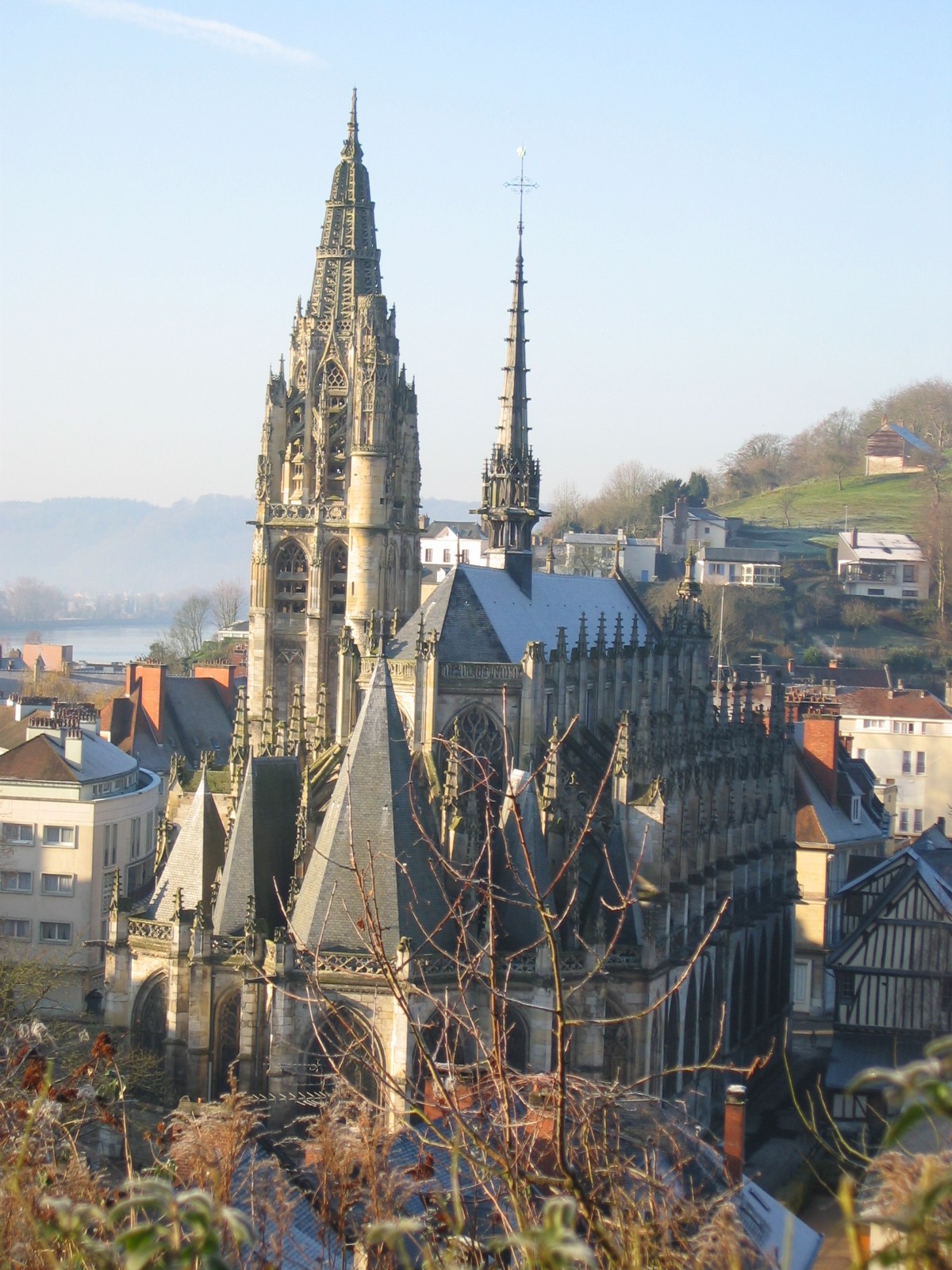
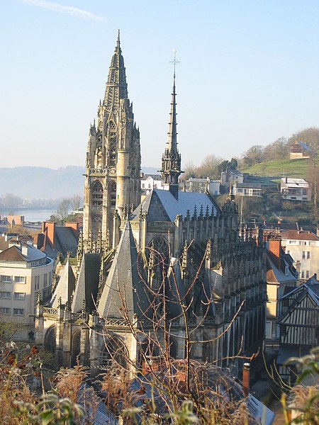
Caudebec-en-Caux, Normandy, church chevet. Personal picture taken by user Urban, 2004

|
Däl pagevon ad kopiedön, seagivön e/u votükön dokümi at ma Dälazöt ad Dokümam Libik: GNU, Fomam: 1.2 u nulikum fa el Free Software Foundation (Stitod: Nünömaprograms libik); nen diläds nevotükovik, nen vödems tegapada balid, e leigo nen vödems tegapada lätik. Kopied dälazöta pekeninon in diläd: Dälazöt ad Dokümam Libik: GNU panemöl. |
| This file is licensed under the Creative Commons Attribution-Share Alike 3.0 Unported license. | ||
| ||
| This licensing tag was added to this file as part of the GFDL licensing update. |
| Object location | | View this and other nearby images on: OpenStreetMap |
|---|
Jenotem ragiva
Välolös däti/timi ad logön ragivi soäsä äbinon ün tim at.
| Dät/Tim | Magodil | Mafots | Geban | Küpet | |
|---|---|---|---|---|---|
| anuik | 00:56, 2011 dekul 10id | | 1,200 × 1,600 (437 KB) | Rotatebot | Bot: Image rotated by 270° (EXIF-Orientation set from 6 to 1, rotated 0°) |
| 07:08, 2005 febul 10id |  | 1,600 × 1,200 (437 KB) | Urban~commonswiki | Caudebec-en-Caux, Normandy, church chevet. Personal picture taken by user Urban, 2004 {{GFDL}} |
Yüms
Pads sököl payümons ko pad at:
Ragivigeb Valöpik
The following other wikis use this file:
- Geb su ast.wikipedia.org
- Geb su ca.wikipedia.org
- Geb su ceb.wikipedia.org
- Geb su ce.wikipedia.org
- Geb su en.wikipedia.org
- Geb su eo.wikipedia.org
- Geb su es.wikipedia.org
- Geb su eu.wikipedia.org
- Geb su fi.wikipedia.org
- Geb su fr.wikipedia.org
- Pays de Caux
- Caudebec-en-Caux
- Betteville
- Saint-Arnoult (Seine-Maritime)
- Sainte-Marguerite-sur-Duclair
- Vatteville-la-Rue
- Histoire du pays de Caux
- Liste des monuments historiques protégés en 1840
- Église Notre-Dame de Caudebec-en-Caux
- Utilisateur:Xfigpower/1840
- Liste des monuments historiques de l'arrondissement de Rouen
- Discussion:Liste des monuments historiques protégés en 1840/Wikidata
- Liste des églises de la Seine-Maritime
- Geb su hu.wikipedia.org
- Geb su it.wikipedia.org
- Geb su ja.wikipedia.org
- Geb su ku.wikipedia.org
- Geb su la.wikipedia.org
- Geb su lld.wikipedia.org
- Geb su mg.wikipedia.org
- Geb su nl.wikipedia.org
- Geb su oc.wikipedia.org
- Geb su pl.wikipedia.org
- Geb su pt.wikipedia.org
- Geb su ro.wikipedia.org
- Geb su ru.wikipedia.org
- Geb su sk.wikipedia.org
- Geb su sr.wikipedia.org
- Geb su sv.wikipedia.org
- Geb su tt.wikipedia.org
- Geb su uk.wikipedia.org
View more global usage of this file.