
Ragiv:Dola aerial.jpg

Size of this preview: 800 × 600 pixels. Other resolutions: 320 × 240 pixels • 640 × 480 pixels • 1,024 × 768 pixels • 1,280 × 960 pixels • 2,272 × 1,704 pixels.
Ragiv rigik (2,272 × 1,704 pixel, ragivagret: 1.36 MB, pated MIME: image/jpeg)
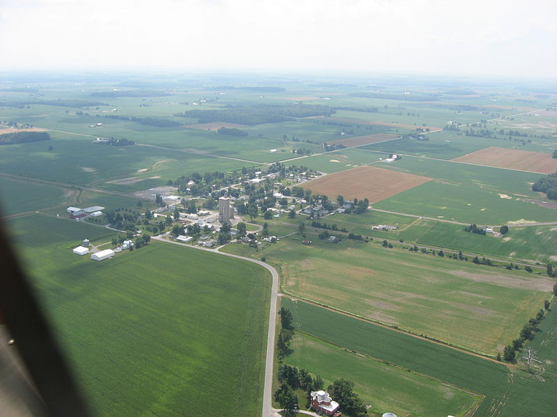
| Bepenam | The unincorporated community of Dola in Washington Township, Hardin County, Ohio, United States. Picture taken from a Diamond Eclipse light airplane at an altitude of 1,800 feet MSL and a bearing of approximately 143º. Please forgive dark line on left side, a part of the plane's canopy glass that shouldn't have been in the picture. | ||
| Dät | Taken on 29 yulul 2008 | ||
| Fon | Vobot okik | ||
| Lautan | Nyttend | ||
| Däl (Reusing this file) |
|
Jenotem ragiva
Välolös däti/timi ad logön ragivi soäsä äbinon ün tim at.
| Dät/Tim | Magodil | Mafots | Geban | Küpet | |
|---|---|---|---|---|---|
| anuik | 19:10, 2008 gustul 19id | | 2,272 × 1,704 (1.36 MB) | Nyttend | {{Information |Description=The {{w|unincorporated area|unincorporated community}} of {{w|Dola, Ohio|Dola}} in {{w|Washington Township, Hardin County, Ohio|Washington Township}}, {{w|Hardin County, Ohio|Hardin County}}, {{w|Ohio}}, {{w|United States}}. Pi |
Yüms
Pads nonik peyümons ad ragiv at.
Ragivigeb Valöpik
The following other wikis use this file:
- Geb su azb.wikipedia.org
- Geb su ceb.wikipedia.org
- Geb su ce.wikipedia.org
- Geb su en.wikipedia.org
- Geb su es.wikipedia.org
- Geb su fa.wikipedia.org
- Geb su lld.wikipedia.org
- Geb su pl.wikipedia.org
- Geb su pt.wikipedia.org
- Geb su sh.wikipedia.org
- Geb su sr.wikipedia.org
- Geb su tt.wikipedia.org
- Geb su uk.wikipedia.org
- Geb su www.wikidata.org