
Ragiv:Hatfield House - the Old Palace - geograph.org.uk - 1839366.jpg
Gretot dajona büfik at: 800 × 530 pixels. Votik(s) magodadensitöfs: 320 × 212 pixels • 640 × 424 pixels • 1,024 × 679 pixels.
Ragiv rigik (1,024 × 679 pixel, ragivagret: 300 KB, pated MIME: image/jpeg)
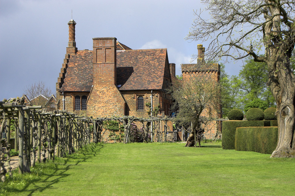
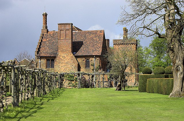
This is a photo of listed building number 1348152. |
Plän brefik
| Bepenam |
English: Hatfield House: the Old Palace, near to Hatfield, Hertfordshire, Great Britain.
View of south face. |
| Dät | |
| Fon | From geograph.org.uk; transferred by User:Skinsmoke using geograph_org2commons. |
| Lautan | Andrew Hackney |
| Däl (Dönugebön nünedi at) |
Creative Commons Attribution Share-alike license 2.0 |
| Dut (required by the license) | Andrew Hackney / Hatfield House: the Old Palace / |
| Camera location | | View this and other nearby images on: OpenStreetMap |
|---|
| Object location | | View this and other nearby images on: OpenStreetMap |
|---|
_region:GB-GBN_heading:0.00&language=vo)
Dälastad

|
This image was taken from the Geograph project collection. See this photograph's page on the Geograph website for the photographer's contact details. The copyright on this image is owned by Andrew Hackney and is licensed for reuse under the Creative Commons Attribution-ShareAlike 2.0 license.
|
This file is licensed under the Creative Commons Attribution-Share Alike 2.0 Generic license.
Dut: Andrew Hackney
- Binol libik:
- gevön ad kobädadalab – kopiedön, pakön e lovegivön voboti
- votabevobön – lönedükön voboti
- Bai stips sököl:
- dut – Mutol nunön lautanagitätanüni pötöfik, gevön yümi lä dälazöt e mäkön, üf votükams pädunons. Dalol dunön osi ön mod suemovik alik, ab no ön mod alseimik ut, kel tikodükon, äsif gitätan bai dälazöt lobülon-la oli u gebi olik.
- paköl ön mod ot – If votabevobol, votafomol u lölöfükol materi, mutol pakön keblünotis olik asä rigädikis bai stips ela same or compatible license.
Jenotem ragiva
Välolös däti/timi ad logön ragivi soäsä äbinon ün tim at.
| Dät/Tim | Magodil | Mafots | Geban | Küpet | |
|---|---|---|---|---|---|
| anuik | 17:59, 2011 mayul 30id | | 1,024 × 679 (300 KB) | File Upload Bot (Magnus Manske) |
Yüms
Pads sököl payümons ko pad at:
Ragivigeb Valöpik
Proyegs votik sököl di ‚wiki’ gebons nünedi at:
- Geb su ar.wikipedia.org
- Geb su arz.wikipedia.org
- Geb su azb.wikipedia.org
- Geb su bg.wikipedia.org
- Geb su ca.wikipedia.org
- Geb su ceb.wikipedia.org
- Geb su cy.wikipedia.org
- Geb su dag.wikipedia.org
- Geb su de.wikipedia.org
- Geb su de.wikivoyage.org
- Geb su en.wikipedia.org
- Geb su en.wikivoyage.org
- Geb su es.wikipedia.org
- Geb su eu.wikipedia.org
- Geb su fa.wikipedia.org
- Geb su ga.wikipedia.org
- Geb su he.wikipedia.org
- Geb su it.wikivoyage.org
- Geb su lld.wikipedia.org
- Geb su lv.wikipedia.org
- Geb su nn.wikipedia.org
- Geb su ro.wikipedia.org
- Geb su ru.wikipedia.org
- Geb su sv.wikipedia.org
- Geb su tr.wikipedia.org
- Geb su ur.wikipedia.org
- Geb su www.wikidata.org