
Ragiv:India Tamil Nadu location map.svg

Size of this PNG preview of this SVG file: 483 × 600 pixels. Other resolutions: 193 × 240 pixels • 387 × 480 pixels • 619 × 768 pixels • 825 × 1,024 pixels • 1,650 × 2,048 pixels • 1,591 × 1,975 pixels.
Ragiv rigik (ragiv in fomät: SVG, magodaziöbs 1,591 × 1,975, gretot: 840 KB)
Plän brefik
| Bepenam |
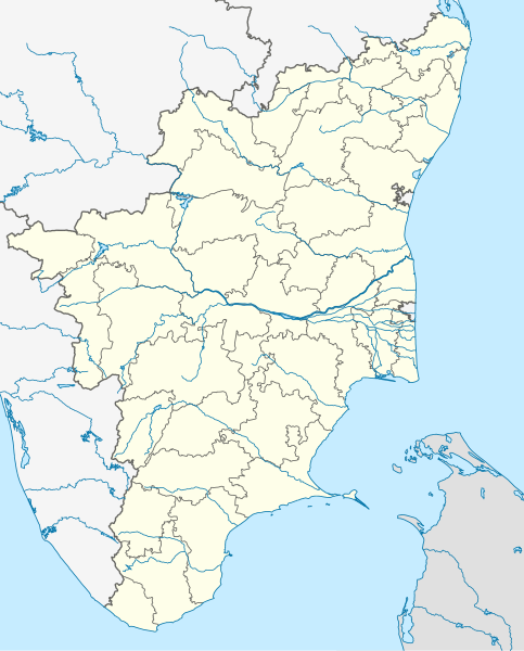
Deutsch: Postionskarte von Tamil Nadu
Quadratische Plattkarte. Geographische Begrenzung der Karte:
English: Location map of Tamil Nadu
Equirectangular projection. Geographic limits of the map:
|
| Dät | |
| Fon | own work, using this file by Planemad |
| Lautan | Maximilian Dörrbecker (Chumwa) |
| Other versions |
|


|
This map has been made or improved in the German Kartenwerkstatt (Map Lab). You can propose maps to improve as well.
|
Dälastad
I, the copyright holder of this work, hereby publish it under the following licenses:

|
Däl pagevon ad kopiedön, seagivön e/u votükön dokümi at ma Dälazöt ad Dokümam Libik: GNU, Fomam: 1.2 u nulikum fa el Free Software Foundation (Stitod: Nünömaprograms libik); nen diläds nevotükovik, nen vödems tegapada balid, e leigo nen vödems tegapada lätik. Kopied dälazöta pekeninon in diläd: Dälazöt ad Dokümam Libik: GNU panemöl. |
This file is licensed under the Creative Commons Attribution-Share Alike 3.0 Unported license.
- Binol libik:
- to share – to copy, distribute and transmit the work
- to remix – to adapt the work
- Under the following conditions:
- attribution – You must give appropriate credit, provide a link to the license, and indicate if changes were made. You may do so in any reasonable manner, but not in any way that suggests the licensor endorses you or your use.
- share alike – If you remix, transform, or build upon the material, you must distribute your contributions under the same or compatible license as the original.
You may select the license of your choice.
Jenotem ragiva
Välolös däti/timi ad logön ragivi soäsä äbinon ün tim at.
| Dät/Tim | Magodil | Mafots | Geban | Küpet | |
|---|---|---|---|---|---|
| anuik | 00:54, 2021 setul 6id | | 1,591 × 1,975 (840 KB) | C1MM | Corrected Tirunelveli/Tenkasi dist boundary |
| 16:43, 2021 setul 4id |  | 1,591 × 1,975 (840 KB) | C1MM | Resized file | |
| 06:09, 2021 setul 4id |  | 907 × 1,123 (880 KB) | C1MM | Removed extra river piece | |
| 04:35, 2021 setul 4id |  | 907 × 1,123 (880 KB) | C1MM | Corrected rivers and dist boundaries | |
| 16:44, 2021 febul 20id |  | 512 × 636 (727 KB) | C1MM | Corrected coastline | |
| 00:35, 2020 dekul 18id |  | 512 × 636 (257 KB) | C1MM | Relayered | |
| 22:06, 2020 prilul 22id |  | 512 × 636 (373 KB) | C1MM | Restore colors | |
| 20:03, 2020 prilul 22id |  | 512 × 636 (373 KB) | C1MM | Fixed colors and colored Pondicherry | |
| 14:18, 2020 mäzul 17id |  | 512 × 636 (250 KB) | C1MM | Reverted to version as of 14:17, 17 March 2020 (UTC) | |
| 14:18, 2020 mäzul 17id |  | 512 × 636 (249 KB) | C1MM | Reverted to version as of 03:04, 17 March 2020 (UTC) |
Yüms
Pads nonik peyümons ad ragiv at.
Ragivigeb Valöpik
The following other wikis use this file:
- Geb su ar.wikipedia.org
- Geb su as.wikipedia.org
- Geb su azb.wikipedia.org
- چنای
- باتی پاراسری
- باتی پینایور
- باتی کالاتور
- وینانجنی
- ویراوانور
- پیانویلای
- پتای, ویلوپورام
- پتای, کارایکال
- پتای, کودالور
- ویرامودایاناتام
- ویراسولاپورام
- ویراپانچاترام
- پرونقودی, تیروچیراپالی
- پرونقودی, پودوکوتای
- وانامادوی
- ساتانور
- ساتیوایال
- ساتیراکوندان
- ساتانور, پرامبالور
- ساراسواتی ناقار
- سانتیپالایام
- سانتاناقوپالاپورام
- سانانالور
- سانکاراپورام
- سانکاراپاندیاپورام
- کالاکودی
- کالییور
- کالینجییام
- ماتییامپاتی
- کالایور
- کالاتور ت
- دوغو کالاتور
- کالاتیمادام
- کالانقانی
- ماروقالپاتی
- مارودور, کویمباتور
- مارتاندانتورای
- کالاییور
- ساماناتام
- سامالپاتی
- سالوپاپاتی
- ونتریلینقاپورام
- سالیپری
- کاکیوادانپاتی
- ومباکام
View more global usage of this file.