
Ragiv:Issoire depuis la Tour de l'Horloge.jpg

Size of this preview: 800 × 600 pixels. Other resolutions: 320 × 240 pixels • 640 × 480 pixels • 1,024 × 768 pixels • 1,280 × 960 pixels • 2,048 × 1,536 pixels.
Ragiv rigik (2,048 × 1,536 pixel, ragivagret: 1.38 MB, pated MIME: image/jpeg)
Plän brefik
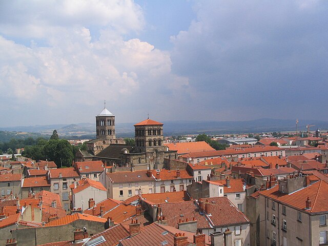
Vue sur la ville d'Issoire, prise depuis la Tour de l'Horloge. Juillet 2006.
| Camera location | | View this and other nearby images on: OpenStreetMap |
|---|
Dälastad
| I, the copyright holder of this work, release this work into the public domain. This applies worldwide. In some countries this may not be legally possible; if so: I grant anyone the right to use this work for any purpose, without any conditions, unless such conditions are required by law. |
Jenotem ragiva
Välolös däti/timi ad logön ragivi soäsä äbinon ün tim at.
| Dät/Tim | Magodil | Mafots | Geban | Küpet | |
|---|---|---|---|---|---|
| anuik | 21:51, 2007 mäzul 9id | | 2,048 × 1,536 (1.38 MB) | Vinckie | Vue sur la ville d'Issoire, prise depuis la Tour de l'Horloge. Juillet 2006. |
Yüms
Pads sököl payümons ko pad at:
Ragivigeb Valöpik
The following other wikis use this file:
- Geb su an.wikipedia.org
- Geb su ast.wikipedia.org
- Geb su br.wikipedia.org
- Geb su ca.wikipedia.org
- Geb su ceb.wikipedia.org
- Geb su ce.wikipedia.org
- Geb su cs.wikipedia.org
- Geb su da.wikipedia.org
- Geb su de.wikipedia.org
- Geb su de.wikivoyage.org
- Geb su en.wikipedia.org
- Geb su eo.wikipedia.org
- Geb su es.wikipedia.org
- Geb su et.wikipedia.org
- Geb su eu.wikipedia.org
- Geb su fa.wikipedia.org
- Geb su fi.wikipedia.org
- Geb su fr.wikipedia.org
- Geb su fr.wikivoyage.org
- Geb su he.wikipedia.org
- Geb su hu.wikipedia.org
- Geb su it.wikipedia.org
- Geb su ja.wikipedia.org
- Geb su ku.wikipedia.org
- Geb su la.wikipedia.org
- Geb su lld.wikipedia.org
- Geb su nl.wikipedia.org
- Geb su nn.wikipedia.org
- Geb su no.wikipedia.org
- Geb su oc.wikipedia.org
- Geb su pl.wikipedia.org
- Geb su pl.wikivoyage.org
- Geb su ro.wikipedia.org
- Geb su ru.wikipedia.org
- Geb su simple.wikipedia.org
- Geb su sk.wikipedia.org
- Geb su sl.wikipedia.org
- Geb su sv.wikipedia.org
- Geb su th.wikipedia.org
- Geb su tr.wikipedia.org
- Geb su tt.wikipedia.org
- Geb su uk.wikipedia.org
- Geb su uz.wikipedia.org
- Geb su vec.wikipedia.org
- Geb su www.wikidata.org
- Geb su zh-min-nan.wikipedia.org