
Ragiv:LocationBangladesh.png
Gretot gudikum no pagebidon.
LocationBangladesh.png (250 × 115 pixel, ragivagret: 5 KB, pated MIME: image/png)
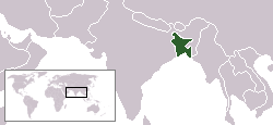
Location map for Bangladesh.
Originally created for English Wikipedia by Vardion. Updated version created by Sheehan.
| |
This work has been released into the public domain by its author, Vardion, at the Linglänapük Vükiped project. This applies worldwide. In case this is not legally possible: |

|
File:LocationBangladesh.svg is a vector version of this file. It should be used in place of this PNG file when not inferior.
File:LocationBangladesh.png → File:LocationBangladesh.svg
For more information, see Help:SVG. |
 |
Jenotem ragiva
Välolös däti/timi ad logön ragivi soäsä äbinon ün tim at.
| Dät/Tim | Magodil | Mafots | Geban | Küpet | |
|---|---|---|---|---|---|
| anuik | 22:14, 2006 yunul 29id | | 250 × 115 (5 KB) | Jed | |
| 16:01, 2004 dekul 5id |  | 250 × 115 (6 KB) | EugeneZelenko | Location map for Bangladesh.<br/>Originally created for English Wikipedia by Vardion.<br/>{{GFDL}} |
Yüms
Pads nonik peyümons ad ragiv at.
Ragivigeb Valöpik
The following other wikis use this file:
- Geb su arz.wikipedia.org
- Geb su bg.wikipedia.org
- Geb su bn.wikibooks.org
- Geb su de.wiktionary.org
- Geb su el.wikinews.org
- Geb su en.wikipedia.org
- Geb su en.wikibooks.org
- Geb su en.wikinews.org
- Geb su en.wikivoyage.org
- Geb su en.wiktionary.org
- Geb su es.wikipedia.org
- Geb su eu.wiktionary.org
- Geb su fr.wikibooks.org
- Geb su fr.wikinews.org
- Geb su fr.wiktionary.org
- Geb su he.wikivoyage.org
- Geb su hr.wikipedia.org
- Geb su hr.wiktionary.org
View more global usage of this file.