
Ragiv:L’église de Canteloup.JPG

Size of this preview: 800 × 416 pixels. Other resolutions: 320 × 167 pixels • 640 × 333 pixels • 1,024 × 533 pixels • 1,597 × 831 pixels.
Ragiv rigik (1,597 × 831 pixel, ragivagret: 962 KB, pated MIME: image/jpeg)
| Camera location | | View this and other nearby images on: OpenStreetMap |
|---|
Plän brefik
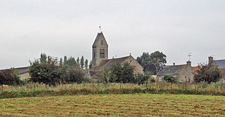
| Bepenam | l'église de Canteloup, Manche vue de loin |
| Dät | |
| Fon | Self-photographed |
| Lautan | Terfili |
Dälastad
| I, the copyright holder of this work, release this work into the public domain. This applies worldwide. In some countries this may not be legally possible; if so: I grant anyone the right to use this work for any purpose, without any conditions, unless such conditions are required by law. |
Jenotem ragiva
Välolös däti/timi ad logön ragivi soäsä äbinon ün tim at.
| Dät/Tim | Magodil | Mafots | Geban | Küpet | |
|---|---|---|---|---|---|
| anuik | 10:18, 2020 tobul 22id | | 1,597 × 831 (962 KB) | Teddyyy | recadrage et éclaircissement |
| 21:11, 2007 tobul 6id |  | 2,048 × 1,536 (650 KB) | Terfili | == Summary == {{Information |Description=l'eglise de Canteloup, Manche vu de lointain |Source=taken by myself |Date=Août 2007 |Author= Chlämens }} == Licensing == {{PD-self}} Category:Canteloup, Manche |
Yüms
Pads nonik peyümons ad ragiv at.
Ragivigeb Valöpik
The following other wikis use this file:
- Geb su ca.wikipedia.org
- Geb su ceb.wikipedia.org
- Geb su ce.wikipedia.org
- Geb su diq.wikipedia.org
- Geb su en.wikipedia.org
- Geb su eo.wikipedia.org
- Geb su es.wikipedia.org
- Geb su eu.wikipedia.org
- Geb su fr.wikipedia.org
- Geb su hu.wikipedia.org
- Geb su it.wikipedia.org
- Geb su ms.wikipedia.org
- Geb su pl.wikipedia.org
- Geb su ro.wikipedia.org
- Geb su sr.wikipedia.org
- Geb su tt.wikipedia.org
- Geb su uk.wikipedia.org
- Geb su uz.wikipedia.org
- Geb su vec.wikipedia.org
- Geb su www.wikidata.org
- Geb su zh-min-nan.wikipedia.org
- Geb su zh.wikipedia.org