
Ragiv:Map of Kentucky highlighting Fayette County.svg

Size of this PNG preview of this SVG file: 800 × 345 pixels. Other resolutions: 320 × 138 pixels • 640 × 276 pixels • 1,024 × 441 pixels • 1,280 × 551 pixels • 2,560 × 1,103 pixels • 6,770 × 2,916 pixels.
Ragiv rigik (ragiv in fomät: SVG, magodaziöbs 6,770 × 2,916, gretot: 127 KB)
Plän brefik
| Bepenam |
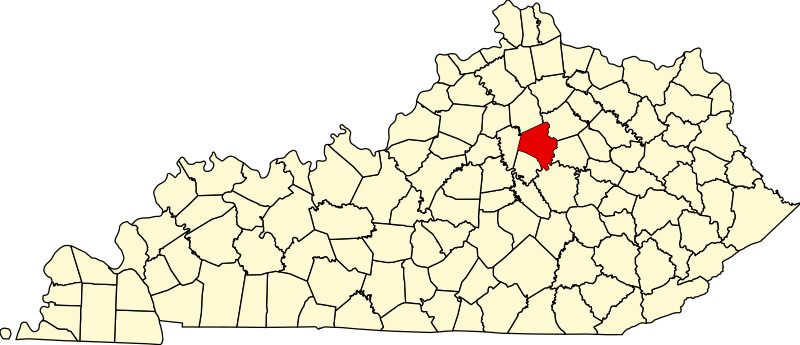
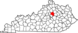
English: This is a locator map showing Fayette County in Kentucky. For more information, see Commons:United States county locator maps. |
| Dät | |
| Fon |
Vobot okik: English: The maps use data from nationalatlas.gov, specifically countyp020.tar.gz on the Raw Data Download page. The maps also use state outline data from statesp020.tar.gz. The Florida maps use hydrogm020.tar.gz to display Lake Okeechobee. |
| Lautan | David Benbennick |
Dälastad
| I, the copyright holder of this work, release this work into the public domain. This applies worldwide. In some countries this may not be legally possible; if so: I grant anyone the right to use this work for any purpose, without any conditions, unless such conditions are required by law. |
Jenotem ragiva
Välolös däti/timi ad logön ragivi soäsä äbinon ün tim at.
| Dät/Tim | Magodil | Mafots | Geban | Küpet | |
|---|---|---|---|---|---|
| anuik | 12:21, 2006 febul 12id | | 6,770 × 2,916 (127 KB) | David Benbennick | {{subst:User:Dbenbenn/clm|county=Fayette County|state=Kentucky}} |
Yüms
Pads sököl payümons ko pad at:
Ragivigeb Valöpik
The following other wikis use this file:
- Geb su af.wikipedia.org
- Geb su ang.wikipedia.org
- Geb su ar.wikipedia.org
- Geb su arz.wikipedia.org
- Geb su ast.wikipedia.org
- Geb su bg.wikipedia.org
- Geb su bpy.wikipedia.org
- Geb su br.wikipedia.org
- Geb su ca.wikipedia.org
- Geb su cdo.wikipedia.org
- Geb su ceb.wikipedia.org
- Geb su ce.wikipedia.org
- Geb su cs.wikipedia.org
- Geb su cy.wikipedia.org
- Geb su da.wikipedia.org
- Geb su de.wikipedia.org
- Geb su el.wikipedia.org
- Geb su en.wikipedia.org
- Lexington, Kentucky
- Fayette County, Kentucky
- Kentucky Horse Park Arboretum
- List of counties in Kentucky
- Lexington–Fayette–Richmond–Frankfort combined statistical area
- CenterCourt
- Athens, Kentucky
- National Register of Historic Places listings in Fayette County, Kentucky
- Hilton Lexington/Downtown
- Bryan Station, Lexington, Kentucky
- Bell Court, Lexington
- Fairway, Lexington
- Kenwick, Lexington
- Eastland, Lexington
- Joyland, Lexington
- Winburn, Lexington
- Highland Park, Lexington
- Garden Springs, Lexington
- Beaumont Park, Lexington
- Gardenside, Lexington
- Mount Tabor, Lexington
- Rabbit Run, Lexington
- Speigle Heights, Lexington
- Melrose Park, Lexington
- Stonewall, Lexington
- Picadome, Lexington
- Harrods Hill, Lexington
- Palomar Hills, Lexington
- Firebrook, Lexington
View more global usage of this file.