
Ragiv:Map of Ontario CHATHAM-KENT.svg

Size of this PNG preview of this SVG file: 340 × 330 pixels. Other resolutions: 247 × 240 pixels • 495 × 480 pixels • 791 × 768 pixels • 1,055 × 1,024 pixels • 2,110 × 2,048 pixels.
Ragiv rigik (ragiv in fomät: SVG, magodaziöbs 340 × 330, gretot: 84 KB)
Plän brefik
This W3C-unspecified vector image was created with Inkscape .
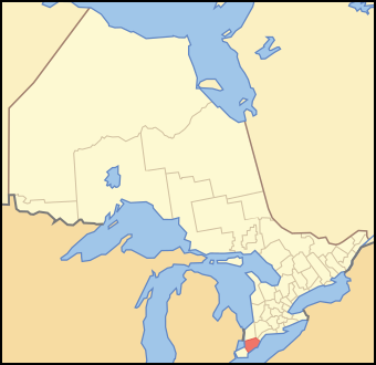
| Bepenam | A map of Ontario showing the location of Chatham-Kent |
| Dät | |
| Fon | Crop and trace of Image:Canada (geolocalisation).svg; trace of Image:Ontario subdivisions.PNG. |
| Lautan | Vidioman |
| Other versions | en:Image:Ontchk.PNG |
.svg)
Dälastad
| I, the copyright holder of this work, release this work into the public domain. This applies worldwide. In some countries this may not be legally possible; if so: I grant anyone the right to use this work for any purpose, without any conditions, unless such conditions are required by law. |
Jenotem ragiva
Välolös däti/timi ad logön ragivi soäsä äbinon ün tim at.
| Dät/Tim | Magodil | Mafots | Geban | Küpet | |
|---|---|---|---|---|---|
| anuik | 13:37, 2007 tobul 16id | | 340 × 330 (84 KB) | Vidioman | {{Created with Inkscape}} {{Information |Description=A map of Ontario showing the location of Chatham-Kent |Source=Crop and trace of Image:Canada (geolocalisation).svg; trace of [http://en.wikipedia.org/wiki/Image:Ontario |
.svg)
Yüms
Pads sököl payümons ko pad at:
Ragivigeb Valöpik
The following other wikis use this file:
- Geb su ar.wikipedia.org
- Geb su arz.wikipedia.org
- Geb su ca.wikipedia.org
- Geb su ceb.wikipedia.org
- Geb su diq.wikipedia.org
- Geb su el.wikipedia.org
- Geb su en.wikipedia.org
- Geb su eo.wikipedia.org
- Geb su fa.wikipedia.org
- Geb su fi.wikipedia.org
- Geb su it.wikipedia.org
- Geb su ja.wikipedia.org
- Geb su pl.wikipedia.org
- Geb su sv.wikipedia.org
- Geb su uk.wikipedia.org
- Geb su ur.wikipedia.org
- Geb su www.wikidata.org
- Geb su zh.wikipedia.org