
Ragiv:Obcine Slovenija 2006.svg

Size of this PNG preview of this SVG file: 800 × 522 pixels. Other resolutions: 320 × 209 pixels • 640 × 418 pixels • 1,024 × 668 pixels • 1,280 × 835 pixels • 2,560 × 1,670 pixels • 2,613 × 1,705 pixels.
Ragiv rigik (ragiv in fomät: SVG, magodaziöbs 2,613 × 1,705, gretot: 2.31 MB)
Plän brefik
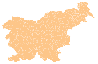
| Bepenam | Map of the municipalities (občine) of the Republic of Slovenia, as since May 2006 (210 units). |
| Dät | |
| Fon | Source of the public data is GURS (Geodetska uprava Republike Slovenije or Surveying and Mapping Authority of the Republic of Slovenia). Converted from Shapefile to SVG with shp2svg and prepared for Wikipedia by romanm (talk). |
| Lautan | See above. |
| Däl (Reusing this file) |
See Pogoji uporabe (in Slovene) and Terms and conditions (English). According to price list, which states cost 0€ for using free-of-charge published data on municipalities even for commercial purposes(!), I consider the data to be in public domain. I also hereby grant my work on this file to be in public domain. |
| Other versions |
|

Dälastad
| I, the copyright holder of this work, release this work into the public domain. This applies worldwide. In some countries this may not be legally possible; if so: I grant anyone the right to use this work for any purpose, without any conditions, unless such conditions are required by law. |
Jenotem ragiva
Välolös däti/timi ad logön ragivi soäsä äbinon ün tim at.
| Dät/Tim | Magodil | Mafots | Geban | Küpet | |
|---|---|---|---|---|---|
| anuik | 16:19, 2012 prilul 13id | | 2,613 × 1,705 (2.31 MB) | Martin Kraft | size and display problem fixed reduced number of points |
| 21:32, 2008 novul 3id |  | 2,613 × 1,705 (2.36 MB) | Romanm | fixed aspect ratio Category:Maps of administrative units of Slovenia | |
| 21:21, 2008 novul 3id |  | 512 × 334 (2.36 MB) | Romanm | {{Information |Description=Map of the municipalities (''občine'') of the Republic of Slovenia, as since May 2006 (211 units). |Source=Source of [http://www.gu.gov.si/si/delovnapodrocja_gu/podatki_gu/brezplani_podatki/brezplani_podatki_obine/ the public d |
Yüms
Pads nonik peyümons ad ragiv at.
Ragivigeb Valöpik
The following other wikis use this file:
- Geb su ast.wikipedia.org
- Geb su azb.wikipedia.org
- Geb su cs.wikipedia.org
- Geb su de.wikipedia.org
- Geb su eu.wikipedia.org
- Geb su kbd.wikipedia.org
- Geb su la.wikipedia.org
- Geb su sco.wikipedia.org
- Geb su sl.wikipedia.org
- Geb su vi.wikipedia.org