
Ragiv:Outline Map of Perm Krai.svg

Size of this PNG preview of this SVG file: 476 × 599 pixels. Other resolutions: 191 × 240 pixels • 381 × 480 pixels • 610 × 768 pixels • 814 × 1,024 pixels • 1,628 × 2,048 pixels • 1,000 × 1,258 pixels.
Ragiv rigik (ragiv in fomät: SVG, magodaziöbs 1,000 × 1,258, gretot: 203 KB)
Plän brefik
| Bepenam |
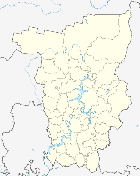
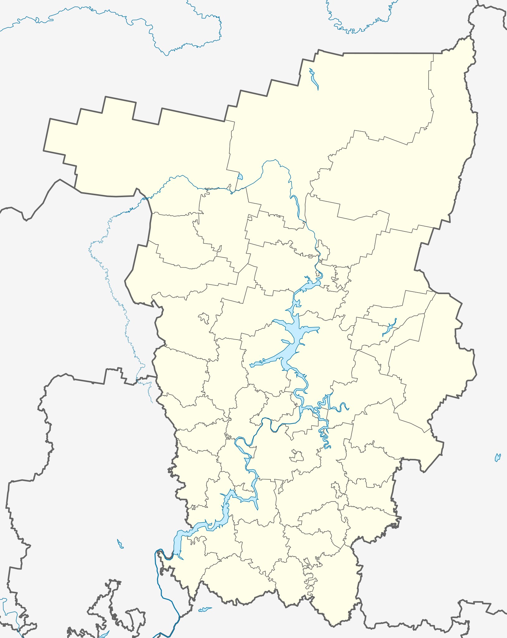
Русский: Позиционная карта Пермского края
|top = 62 |bottom = 56 |left = 51 |right = 60 |
| Dät | |
| Fon |
Vobot okik This W3C-unspecified vector image was created with Inkscape . |
| Lautan | Виктор В |
| Other versions |
[] |


Dälastad
| I, the copyright holder of this work, release this work into the public domain. This applies worldwide. In some countries this may not be legally possible; if so: I grant anyone the right to use this work for any purpose, without any conditions, unless such conditions are required by law. |
Jenotem ragiva
Välolös däti/timi ad logön ragivi soäsä äbinon ün tim at.
| Dät/Tim | Magodil | Mafots | Geban | Küpet | |
|---|---|---|---|---|---|
| anuik | 19:33, 2010 gustul 22id | | 1,000 × 1,258 (203 KB) | Виктор В | упустил Очерский район |
| 17:56, 2010 gustul 22id |  | 1,000 × 1,258 (201 KB) | Виктор В | Новая версия на основе СТП края | |
| 18:48, 2009 tobul 31id |  | 744 × 1,052 (68 KB) | Виктор В | color | |
| 17:10, 2009 tobul 31id |  | 744 × 1,052 (68 KB) | Виктор В | {{Information |Description={{en|1=Outline Map of Perm Krai}} |Source={{own}} {{Inkscape}} |Author=Виктор В |Date=2009-10-31 |Permission= |other_versions= }} Category:Perm Krai |
Yüms
Pads nonik peyümons ad ragiv at.
Ragivigeb Valöpik
The following other wikis use this file:
- Geb su af.wikipedia.org
- Geb su ar.wikipedia.org
- Geb su azb.wikipedia.org
- ارنا، پرم دیاری
- اوبوینزک
- اوپاری، روسیه
- زاقوووروخا
- اوتوپکووو
- اوتوو، روسیه
- زامارایوو
- اوچات-زون
- زامولیانکا
- اوچخوز، روسیه
- زاوادنیی
- زاوزینووو
- زاووژیک، روسیه
- اودان، روسیه
- اودمورت-شاجیرت
- زایتسی، روسیه
- اودینا، پرم دیاری
- زایکووو، روسیه
- بلویوو، روسیه
- زرنینو، روسیه
- اوراسکووو
- کیژ، روسیه
- اورالسکوی، پرم دیاری
- اورالووو
- اورای، پرم دیاری
- کیشکا، پرم دیاری
- اورخووایا قورا
- اورژا، روسیه
- بوبکی، پرم دیاری
- بوبووایا
- کین، روسیه
- زوبکی، پرم دیاری
- زوروو، پرم دیاری
- زوزری، پرم دیاری
- زولوتانکا
- کئیمن، پرم دیاری
- بور-لیونوا
- کئیمنکا، پرم دیاری
- زونووو، روسیه
- زوونی، روسیه
- کئیمنی کلیوچی
- زویوو، روسیه
- بوردینو، روسیه
- زیپونووو
- اورول، روسیه
- اورولکا، روسیه
- بورشچیووتسی
View more global usage of this file.