
Ragiv:Päijänne and päijätsalo.jpg

Size of this preview: 800 × 533 pixels. Other resolutions: 320 × 213 pixels • 640 × 427 pixels • 1,024 × 683 pixels • 1,280 × 853 pixels • 2,399 × 1,599 pixels.
Ragiv rigik (2,399 × 1,599 pixel, ragivagret: 1.27 MB, pated MIME: image/jpeg)
| Bepenam |
Deutsch: Sonnenuntergang über dem Päijänne-See in Sysmä, Finnland. Rechts im Bild die Insel Päijätsalo, Teil des Päijätsalo Nationalparks.
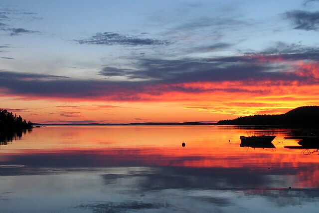
English: Sun setting over Lake Päijänne at Sysmä, Finland. On the right is Päijätsalo island which is part of the Päijätsalo natural park.
Français : Coucher de soleil au lac de Päijänne (municipalité de Sysmä, Finlande). À droite se trouve l'île Päijätsalo qui fait partie du parc national dénommé Päijätsalo.
Italiano: Alba sul Lago Päijänne presso Sysmä, in Finlandia. Sulla destra si trova l'isola Päijätsalo, parte del Parco Naturale Päijätsalo.
Suomi: Auringonlasku Päijänteellä Sysmässä, Suomessa. Oikealla oleva Päijätsalon saari on osa Päijätsalon luonnonpuistoa.
|
| Dät | 31 yulul 2005 (according to Exif data) |
| Fon | Vobot okik |
| Lautan | Joonas Lyytinen |
| Däl (Reusing this file) |
This file is licensed under the Creative Commons Attribution 2.0 Generic license.
|
| Other versions |
 |
| Camera location | | View this and other nearby images on: OpenStreetMap |
|---|
|
This image was selected as picture of the day on Wikimedia Commons for 30 October 2005. It was captioned as follows: Other languages:
Cymraeg: Machlud haul dros Llyn Päijänne, Sysmä, y Findir. Deutsch: Sonnenuntergang am Päijänne-See bei Sysmä, Finnland Latina: Occasus solis in lacum nomine Päijänne, Sysmä in Finnia Norsk bokmål: Sola går ned over Päijänne i Sysmä i Finland. Norsk nynorsk: Sola går ned over Päijänne i Sysmä i Finland. Polski: í Português: Pôr do sol. Русский: Закат солнца над озером Päijänne в Sysmä, Финляндия ไทย: ดวงอาทิตย์ตกเหนือทะเลสาบ Päijänne ใน Sysmä, ประเทศฟินแลนด์ |
Jenotem ragiva
Välolös däti/timi ad logön ragivi soäsä äbinon ün tim at.
| Dät/Tim | Magodil | Mafots | Geban | Küpet | |
|---|---|---|---|---|---|
| anuik | 17:42, 2005 setul 8id | | 2,399 × 1,599 (1.27 MB) | Ikiwaner | fixed the leaning, cropped to 2:3 |
| 20:19, 2005 setul 6id |  | 2,592 × 1,944 (1.96 MB) | Joonasl | Sun setting at Sysmä. Source: Joonas Lyytinen {{cc-by-2.0}} Category:Sysmä\ | |
| 20:17, 2005 setul 6id |  | 2,592 × 1,944 (1.96 MB) | Joonasl | Sun setting at Sysmä. Source: Joonas Lyytinen {{cc-by-2.0}} Category:Sysmä\ |
Yüms
Pads sököl payümons ko pad at:
Ragivigeb Valöpik
The following other wikis use this file:
- Geb su ar.wikipedia.org
- Geb su ar.wiktionary.org
- Geb su ast.wikipedia.org
- Geb su az.wikipedia.org
- Geb su be.wikipedia.org
- Geb su blk.wikipedia.org
- Geb su bo.wikipedia.org
- Geb su ceb.wikipedia.org
- Geb su cs.wikipedia.org
- Geb su cv.wikipedia.org
- Geb su da.wikipedia.org
- Geb su de.wikipedia.org
- Geb su de.wiktionary.org
- Geb su el.wikipedia.org
- Geb su en.wikipedia.org
- Päijät-Häme
- Sysmä
- List of national parks of Finland
- Lake Päijänne
- Päijänne National Park
- User talk:Khoikhoi/Gallery
- Wikipedia:WikiProject Finland
- User talk:Hectorian/Archive 2
- Wikipedia:Wikipedia Signpost/2006-10-23/Interwiki report
- User talk:Editor at Large/Archive/Support :) 1
- User talk:Editor at Large/Archives/While I was gone
- User:Alienlifeformz
- Wikipedia:Wikipedia Signpost/2006-10-23/SPV
- Wikipedia:WikiProject Lakes/Galleries/2
- User:Passargea/Favourite pictures/Nature
- Portal:Finland/Selected picture
- Portal:Finland/Selected picture/2
- Talk:Sunset/Archive 1
- Talk:Sunset/Archive 2
- User talk:Teblick/Archive 2
- User:JPxG/SP 2006-2010
- Wikipedia:Wikipedia Signpost/Single/2006-10-23
- Geb su en.wikivoyage.org
View more global usage of this file.