
Ragiv:Pointe MHNT PRE2010.0.7.2 fond.jpg
Size of this preview: 800 × 465 pixels. Other resolutions: 320 × 186 pixels • 640 × 372 pixels • 1,024 × 595 pixels • 1,280 × 744 pixels • 2,560 × 1,488 pixels • 4,914 × 2,856 pixels.
Ragiv rigik (4,914 × 2,856 pixel, ragivagret: 3.28 MB, pated MIME: image/jpeg)
Plän brefik
| Bepenam |
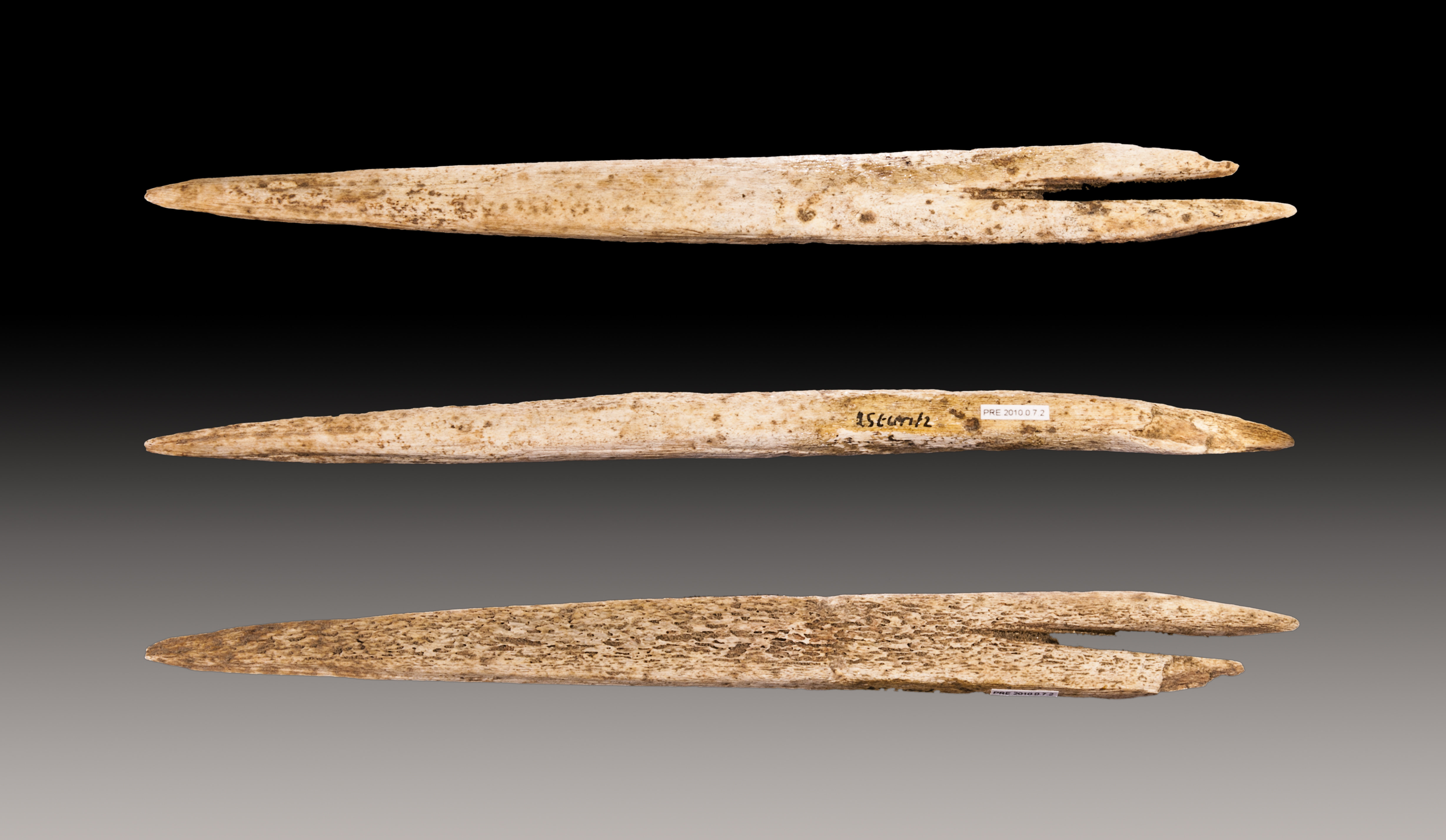
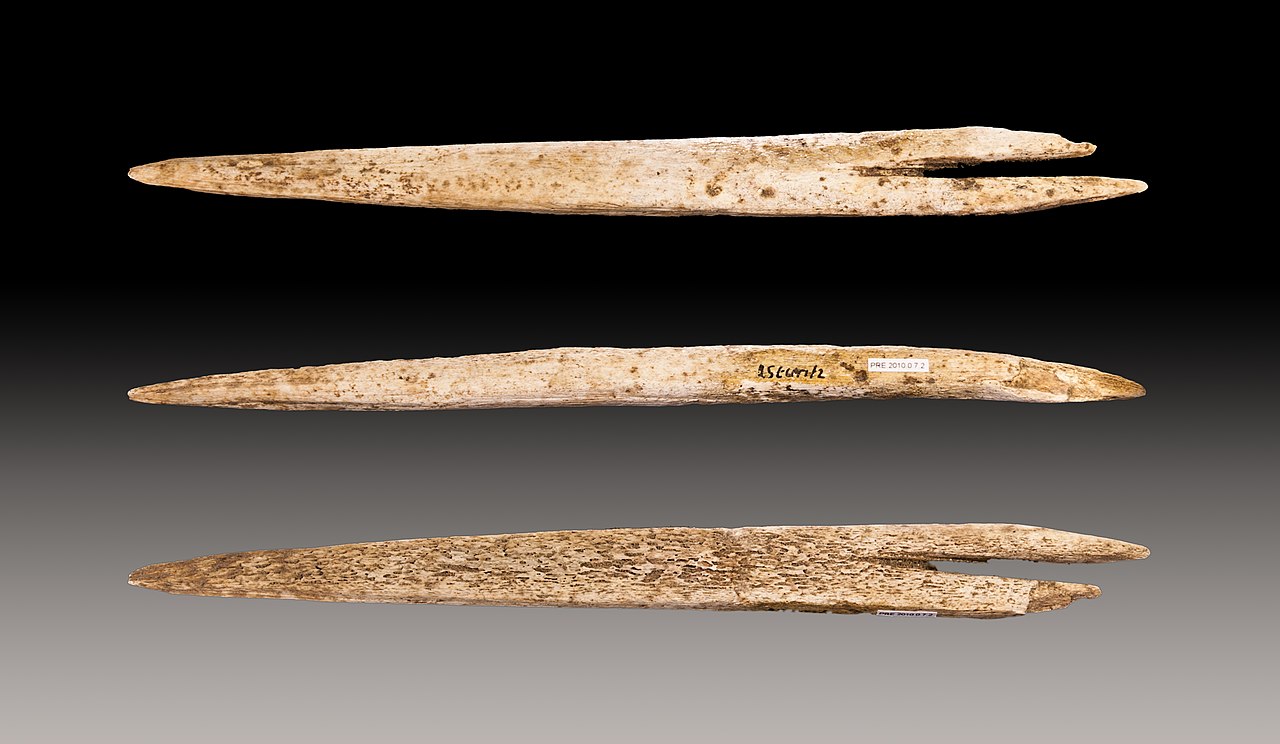
English: Javelin head with fork-based point, currently forming.
Français : Pointe de sagaie à base fourchue, en os de renne, en cours de façonnage.
|
||
| Dät | Taken on 2 gustul 2010 | ||
| Fon | Vobot okik | ||
| Lautan | Didier Descouens | ||
| Däl (Reusing this file) |
I, the copyright holder of this work, hereby publish it under the following license: This file is licensed under the Creative Commons Attribution-Share Alike 4.0 International license.
|
||
| Other versions |
|


| Camera location | | View this and other nearby images on: OpenStreetMap |
|---|

|
This document was made as part of the Projet Phoebus.
|
Jenotem ragiva
Välolös däti/timi ad logön ragivi soäsä äbinon ün tim at.
| Dät/Tim | Magodil | Mafots | Geban | Küpet | |
|---|---|---|---|---|---|
| anuik | 13:59, 2010 gustul 17id | | 4,914 × 2,856 (3.28 MB) | Archaeodontosaurus | {{Information |Description=x |Source={{own}} |Date= |Author= Archaeodontosaurus |Permission= |other_versions= }} |
Yüms
Pads nonik peyümons ad ragiv at.
Ragivigeb Valöpik
The following other wikis use this file:
- Geb su an.wikipedia.org
- Geb su br.wikipedia.org
- Geb su ca.wikipedia.org
- Geb su ceb.wikipedia.org
- Geb su de.wikipedia.org
- Geb su en.wikipedia.org
- Geb su es.wikipedia.org
- Geb su eu.wikipedia.org
- Geb su fr.wikipedia.org
- Geb su gl.wikipedia.org
- Geb su it.wikipedia.org
- Geb su la.wikipedia.org
- Geb su nl.wikipedia.org
- Geb su oc.wikipedia.org
- Geb su pl.wikipedia.org
- Geb su pms.wikipedia.org
- Geb su pt.wikipedia.org
- Geb su simple.wikipedia.org
- Geb su uk.wikipedia.org